I headed more or less due north this week. It was a very pleasant day, but much of the way was very muddy and difficult. That did nothing to stop my enjoyment though!
I made for the Skegby Trail, which took me almost to Pleasley. I then turned left along Longhedge Lane to Stoney Houghton. Footpaths and forest trails took me on to Upper Langwith. I then turned west to Scarcliffe and Palterton. I descended the steep hill to the Stockley Trail, which lead to Glapwell. I then followed the main road towards Pleasley before turning back onto Longhedge Lane and the Skegby Trail.
I started much later than I had planned. I overslept quite badly, I am ashamed to say! I was so late, I had to scrap my original itinerary. It was a beautiful, sunny day. I am very sad not to have seen more of it! The winter sun cast long shadows all day, as you can tell by my silhouette appearing in several of the shots. This first one was near the southern end of the Skegby Trail.
Just before Skegby, there was a beautiful mix of sun and shade in the old railway cutting.I should really have cleaned the camera lens before I started out. Several shots show the watermarks of last week's rain.
Beyond Skegby, much of the route is bordered by vegetation. Even in winter, it is difficult to see a lot either side of the trail. One rare open stretch just south of Pleasley gives a view of the old Pleasley Pit chimney in the far distance.
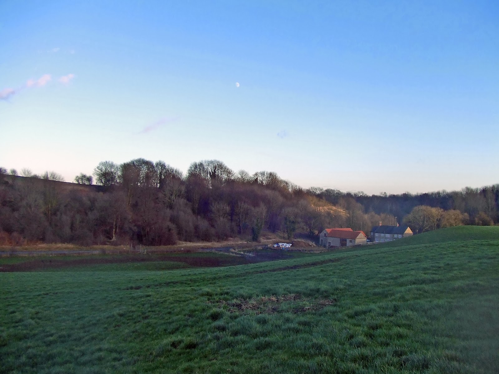
This is a view of Newboundmill Farm, again just south of Pleasley. It gives an idea of what the whole area must have been like before the industrial revolution arrived, with its coal mines and colliery villages.
Immediately south of Pleasley, I turned left onto Longhedge Lane, which runs along the south western edge of the old Pleasley Colliery site - now a nature reserve and park. This was the first of several very wet and muddy sections on this particular walk.
Near the A617 Mansfield-Chesterfield road, it is possible to see the upper part of Hardwick Hall across the fields, in-between the 2 trees in the middle of this photo.
Crossing the A617, I continued north west towards Stony Houghton, seen here on my right as I walked along Green Lane.
Instead of turning right into the village, I carried straight on along a green lane towards the B6417.
Just beyond the junction with the B6417, I turned right along a narrow, winding country road leading round the north side of Stony Houghton towards Shirebrook. After a short distance the Archeological Way footpath crosses the road. I turned north along the footpath towards Roseland Wood. The land is flat up here, at around 170m above sea level. Looking north west across the fields, I had a clear view of Palterton and the southern edge of Bolsover on the horizon. I would be passing through Palterton later on.
Roseland Wood was deathly quiet. Apart from a dog barking in the far distance, I neither saw nor heard any sign of animal or human life. It was just me and the trees!
Between Roseland Wood and Langwith Wood, there is a view of Scarcliffe Village, unfortunately spoiled by power lines - something of a problem elsewhere on my walk, too.
The Archeological Way runs along the south eastern edge of the woods as you approach Upper Langwith. In the very far distance, I could see the steam rising from a power station. The alignment of the path here suggests to me that this is West Burton Power Station near Gainsborough.
The sun was still shining brightly as I approached Nether Langwith village - more or less the northernmost part of my walk.
The church here is very plain, but none the worse for that. Trees make it difficult to get a really good angle for a photo.
I walked along the footpath by the church and across a small valley to the A632. I had decided to head west towards Scarcliffe, as I knew it would be dark in a few hours. This was the view looking back to the north east from the highest point on the A632, near Scarcliffe Lanes Farm. By now there were 2 power stations in view, along the Trent Valley.
Just beyond the farm, the road takes a sharp turn to the right. I headed straight on along a footpath down a steep, wooded bank towards Scarcliffe.
This footpath crossed the direct road from Upper Langwith before climbing steeply again. Most of my photos were taken looking back to where I had come from by now, as the sun was very much in my eyes on this section of the walk. This view looks back towards Upper Langwith, with Gildwells Farm nestling in the valley.
To the north west, a narrow valley leads the eye towards Scarcliffe Grange.
The footpath eventually led onto another muddy lane leading to the edge of Scarcliffe village. Here is the church.
From the church, I walked west before turning sharp left onto Gang Lane. More mud!
Gang Lane did offer a nice view back across the fields towards Scarcliffe.
Just before the woods, a footpath heads through a hedge and across a field on the right. This took me through the Birch Hill Plantation to the B6417. Crossing the road, I headed along Poulterwell Lane (very muddy!)
The moon was clearly visible in the afternoon sky by now. Here is a view looking east, midway along Poulterwell Lane
The lane leads to Palterton, perched on a steep slope above the Doe Lea Valley. The buildings along the edge must have a truly spectacular view.
Here is a panoramic merge of photos to give some idea of the view. The low sun made this difficult to photograph.
The drop is around 100 metres from Palterton to the valley below. This is the start of my descent - not too steep!
Lower down, the hills of the Peak District are still visible on the horizon.
Near the bottom, I turned around to take this view back up the slope to Palterton.
To my right, Bolsover Castle was clearly visible in the distance.
At the bottom of the valley run the Stockley Trail, yet another old railway line converted into a footpath.
This too was muddy in places! On the horizon, looking east, was the silhouette of the spire of Heath church.
Glapwell Hill came into view eventually, with Glapwell village leading up to the top.
I passed Stockwell Pond before the final ascent started.
Looking back again north along the ridge towards Palterton...
.. and south east towards Glapwell.
I followed the main road up to the top of the escarpment and on towards Pleasley. It was getting dark rapidly, so I felt I ought to get a move on. There was a short, red sunset.
This was the view south west along Dale Lane from the main road.
I had the choice of playing it safe and following the main road through Pleasley and round to Kings Mill - or taking a chance in the dark and heading back down Longhedge Lane and the Skegby Trail. It was a beautiful, clear night so I decided to be adventurous! I turned right along Longhedge Lane. I avoided the worst of the mud by walking along one of the paths in the Pleasley Pit Country Park. I managed to get this slightly shaky shot of the pit chimney, the moon and the lake.
It was light enough, even in the dark, to make out where I was. I could clearly see the path ahead. Indeed, the walk was very pleasant. I could hear owls hooting in the distance. To may surprise, I even met someone walking their dog along the trail near Skegby.
Once I reached the main road at Skegby, I decided to follow the street lights home. The next section of the Skegby Trail towards Sutton is in a deep cutting, so I expected it to be very dark.
I do carry a torch with me, by the way - just in case I ever need one. I also have a high-visibility vest to wear if ever I have to walk along roads in the dark.
By the time i got home, my shoes and my jeans below the knees were caked in mud. This is all part of the fun - something to remember from yet another thoroughly enjoyable walk!