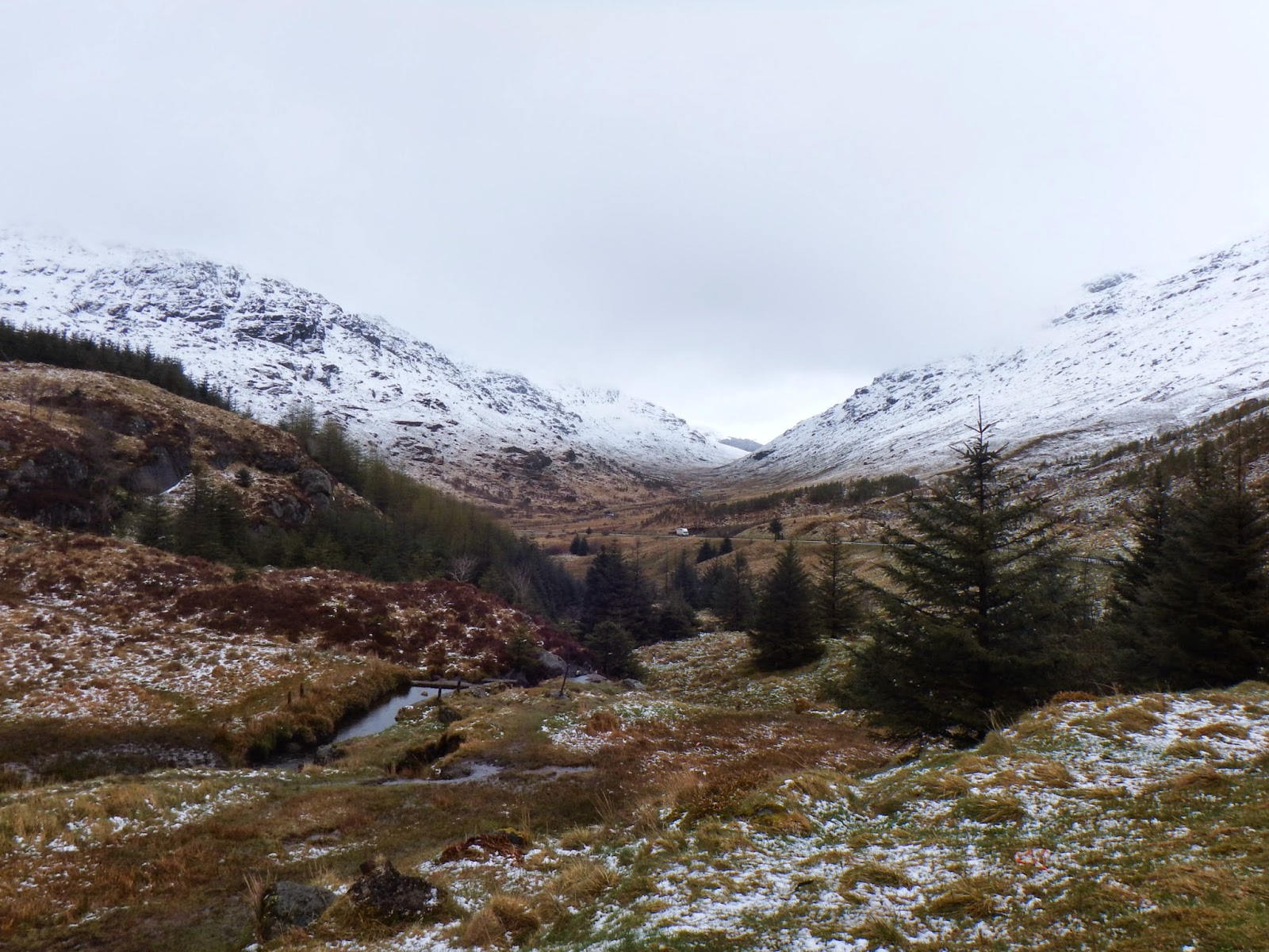
On the Tuesday morning, I woke to a very different scene in Carrick Castle, with light rain and snow on the mountains. Here was the view south along Loch Goil. I resolved to go out in the car again despite the weather. I decided to head north east towards Glencoe, hoping (optimistically) that I might get some nice pictures of snow-capped peaks.

The view north looked very unwelcoming, with cloud and rain shrouding the view.

Mind you, Lochgoilhead looked a real picture, as it was bathed in sunshine as I passed by.

The road out of Loch Goil to the Rest and Be Thankful Pass rises high into the mountains. near the summit, I was well above the snow line. Fortunately, the road was fine.

Here is the view from near Rest and Be Thankful , with the main road descending down towards Arrochar on the far side of the valley.

I followedmy previous day's route to Inveraray, where I turned north towards Dalmally. The weather improved slightly for a while, allowing this view of the snow-capped peaks.
Beyond Dalmally, I followed a side road along Glen Orchy.............

.......passing these beautiful falls along the way.

I eventually rejoined the main road just south of Bridge of Orchy. Just beyond this point, the road climbs steeply, offering excellent views back down the valley over Loch Tulla.

The road then passes over Rannoch Moor, which looked particularly bleak on this day.

The weather quickly closed in, with heavy rain, sleet and snow.

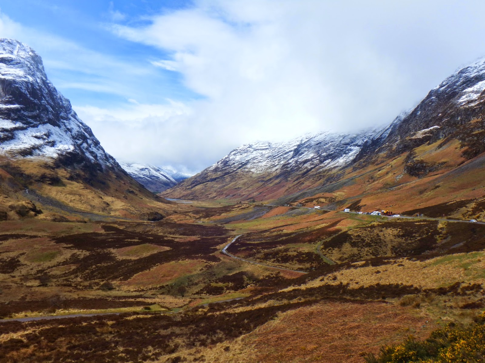
I worried that I might not get much of a view of Glencoe, but amazingly, the sun burnt its way through at just the right time. Here is a view from a lay-by just short of the descent into Glencoe.

A short distance further on, the Pass of Glencoe was simply stunning................ it was worth driving all that way just for this single view!
........or this one of two of the peaks to the south of the Pass.

By the time I got down to the bottom of the pass, the weather had closed in again. I had timed my arrival at the head of Glencoe just right!
Beyond Glencoe, I took the main road south along Loch Linnhe, in the general direction of Oban. Fortunately, the sun came out again, offering excellent views across the Loch. This view is looking north west towards Ardgour.

Slightly further south, I braved the rocky shore for another view in the same general direction.

Nearby was Shuna Island.

Just south of Portnacroich appeared Stalker Castle on a small island in a little bay

Here is a view from the south side.

I turned off the main road at Appin towards Port Appin. This offered more fine views across Loch Linnhe.

Port Appin soon came into view, with green Lismore Island in the background

This is the pier at Port Appin.

I retraced my steps to the main road and continued south to Balcardine. Here, I took the road across to Bonawe. At the top of the pass, I had my first glimpse of Loch Etive.

There was very little at Bonawe, so I turned along Loch Etive past Ardchattan Priory and back onto the main road. The weather had taken another turn for the worse, so I turned inland at Connel Ferry through Taynuilt and the Pass of Brander. Near Dalmally, I turned right for Inveraray, catching a sight of Kilchurn Castle on Loch Awe.

Back at Carrick Castle, the weather was dull, but the morning's snow had already gone.

The next day, I had tired of driving. The snow capped peaks I saw on Tuesday whetted my appetite for more travel. The only alternative was to stay in and read all day, which I could just as well ahve done at home! The weather forecast was for heavy rain though. I decided to take the train from Arrochar and Tarbet to Mallaig. It was raining when I left Arrochar & Tarbet station.

The journey is probably the most amazing in the UK - especially with snow on the mountains, looking like they had been covered in icing sugar. Even better, the weather improved dramatically, the further north and west I travelled. Photography on the train was difficult as the windows are tinted and the interior lights were on. The train did stop at the famous Glenfinnan Viaduct though - so I was able to open the ventilator and bravely stick my hand and my camera through the narrow slot to take this picture of the viaduct.

I also took this view of Loch Shiel (I think!) by holding the camera right up against the window a little further on. Not perfect, but at least it captures the scene.

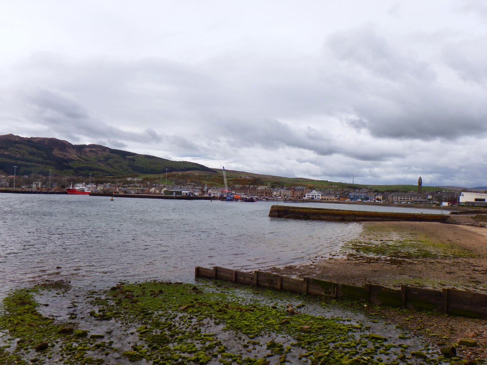
Mallaig was in the middle of a heatwave! Here is my first view of the busy harbour.

This beautiful sailing vessel was moored in the harbour.

The offshore islands were all clearly visible. Here, we see Eigg and Rum in the distance.

I climbed the cliff overlooking the harbour and stitched together this panoramic shot.

This car was being serviced in the harbour area (honest!) The man in blue was checking the tyres just after I took this picture.

Here are some fishing boats. I saw a seal in the water, but not close enough to take a photo of.

On the way back , I braved one picture in the train. It illustrates neatly the problem with reflections, but does look kind of artistic too!

On my return to Arrochar and Tarbet station, it looked very wet, as if it had been raining all day. I was so glad I had taken the train to Mallaig!
The next day, my dear friend Anne kindly offered to drive me around the Cowal Peninsula for the day. By then, my brain was a little over-saturated with wonderful views, so I found it difficult to fully appreciate the beautiful scenery that Cowal offers. Sadly, I only managed a few photos. This one is near the top of The Kyles of Bute with the Isle of Bute, middle right. Loch Riddon is off to the left.

This one is looking back from near the top of Loch Riddon, with the Isle of Bute in the distance on the right.

We crossed to the Isle of Bute from Colintraive. Here is a view of the beautiful Ettrick Bay. The small island of Inchmarnock is straight ahead, with Arran in the distance. The land jutting out middle left is St Ninian's Point on Bute.

Here is a view of Colintraive, as we waited for the ferry back to the mainland.

The next day, Anne and I went on the train to Oban. Oban was just as sunny as Mallaig had been - but very windy! Here is a view of the waterfront.

The local chocolate shop makes its own delicious concoctions. This sign (and others) made purchases very tempting!

The view out to sea was beautiful and clear. Kerrera Island is just behind the boat, with Mull in the far distance.

That's it then - Bulgaria next!