This time, I walked with the Sutton-in-Ashfield Ramblers from Whirlow to Holmesfield via Burbage Moor and Longshaw.
We began at Whirlow, on the south west side of Sheffield. Whirlowbrook Hall was adjacent to the footpath up towards Burbage Moor.
The first part of the walk was up the narrow Limb valley through thick woodland. Apparently, this was part of the border between Northumbria and Mercia at one time and later the boundary between Yorkshire and Derbyshire until recent times.
We caught a brief glimpse of Ringinglow before heading back into woodland, still heading west.
This was a view looking towards Sheffield from just south of Ringinglow village.
Beyond the woodland we came upon Burnage Moor, with a view of the Ox Stones.
This was the view from the other side.
From atop one of the stones, there were some wonderful views into the far distance. This was looking north west towards Rud Hill.
...and back to the east looking over Sheffield
We then carried on over Burbage Moor towards Burbage Rocks - tis was another view to the north west.
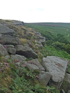
Burbage Rocks form a sheer cliff, in an L shape. This view was looking south.
......as was this view, showing the bend in the middle.
Climbers were scaling the cliffsThis ws a view looking back along the edge of the cliffs towards the north.
At the corner, I took this view looking south east towards Grindleford.
.. and here, a little further along, is the road to Hathersage.
Beyond the end of the rocks, we descended to the Fox House Inn and the National Trust's Longshaw Estate. This is a view from the drive to the visitor centre, looking west.
......and a view from slightly further south.towards Hathersage Moor
In the grounds of the Longshaw Estate is a small lake.
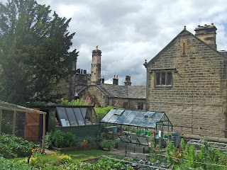
From the garden you get a view of the back of the old Hall.
Climbing south, we got a long distance view towards Hathersage, looking north.
The end of the footpath at the boundary of the Longshaw Estate is called "Wooden Pole" - and you can see the pole in the background. The railway tunnel from Sheffield towards Manchester is under there somewhere.
We were on moorland again by this stage, walking along the edge of Totley Moor.
This was a view looking west in the general direction of Grindleford.
and a view to the south east. Soon afterwards we passed the disused Barbrook Reservoir.
Beyond the reservoir, we turned sharp east. Around here there were long views to the south and east, with long views in the distance of Bolsover Castle, the crooked spire at Chesterfield and other local landmarks..
The cows made way for us, fortunately.........
We then descended steeply into a valley, heading east. It is very wooded around here.
We stopped briefly for a break in some beautiful woodland, next to a stream, just north of Unthank.
.and here is a view of Holmesfield itself as we approached from the valley below.
There was just time to photograph the church before we caught the bus home.
My thanks again to Sutton-in-Ashfield Ramblers for another excellent walk.


