I have decided to take a temporary break from posting walks on this Blog. I shall carry on walking though - I couldn't give that up, even for a short while!
Wednesday 27 August 2014
Monday 4 August 2014
W/C 2nd August 2014 - The Ladybower, Derwent and Howden Reservoirs, Hope Cross and Win Hill
This week, the Sutton-in-Ashfield and District Rambling
Club organised a clockwise walk around the spectacular Ladybower Reservoir, incorporating Win Hill and Hope Cross. Being in an optimistic mood, I decided to do my own extended walk. In addition to most of the main group's circuit, this incorporated the two reservoirs in the Upper Derwent Valley - the Derwent and Howden Reservoirs. My walk was around 20 miles long, roughly twice the length of the group walk.
I went round anticlockwise. This offered more options if I were running late towards the end of the walk. I followed the eastern bank of the northern arm of the Ladybower Reservoir. I continued north beyond the other two reservoirs, then back down the western side of the valley. From the Fairholmes Visitor Centre, I more or less followed the route of the main party, but in reverse. I turned west up the steep hillside to Lockerbrook and Hagg Farm. I then descended to the A57 road before ascending to Hope Cross. From here, I followed the ridge east to Win Hill before descending to the Ladybower Reservoir dam. I finished the walk at the Ladybower Inn, around half-an-hour after the main group had arrived.
The walk began at the Heatherdene Car Park, by the side of the Ladybower Reservoir. I headed north along the adjacent main road. The sky was a little gloomy at this early stage in my walk, but much of the cloud quickly disappeared to give a bright, hot, sunny day. Ashopton Viaduct was visible in the distance, where the A57 crosses the Derwent Valley arm of the reservoir.

The water disguises the true depth of the viaduct. Here is a photo of it during construction, with the soon-to-be-demolished village of Ashopton below.

I turned left onto the A57, then crossed the road and headed up a trackway along the eastern side of the reservoir. The view up the Upper Derwent Valley was very beautiful and inviting.

Here is a view looking back to the south, with the Ashopton Viaduct in the distance. Win Hill is visible behind the viaduct. This summit would be the last major challenge of my walk, late in the afternoon.

Much of the steeply-sided valley is heavily wooded, obstructing the views of the reservoirs and the landscapes generally. The trees did provide some welcome shade from the sun though, as the day got warmer. The paths along both sides of the valley are of high quality, suitable for cycling as well as walking.

Occasionally, the view did open out, as here, not far south of the site of Derwent Village.

Most of Derwent Village was demolished and the site flooded when the Ladybower Reaservoir was built. There are a few remains, like this gateway oddly placed in what is now the middle of a field.

An information board gives some details of the old village, including this photo taken just as the buildings were being demolished.
 Some foundations of buildings were just above the waterline.

The gate pillars for the old vicarage can be seen on the left of this photo.

Beyond here, a few other structures remain, including the old school house and this postbox.

The head of the Ladybower Reservoir has a small wooded area, seen here in the distance, before the dam for the Derwent Reservoir.

Here is a view of the Derwent Dam, taken from just upstream.

Beyond the dam, the Derwent Reservoir and the Upper Derwent Valley continues through the landscape.

There are a few smaller side valleys, including this one on the western side, at Ouzleden Clough.

The Derwent Reservoir was less than full, as shown here, at the head of the reservoir. One of the towers of the Howden Dam is visible through the trees.

The water level in the Howden Reservoir was much lower than in the two previous reservoirs, as evidenced by the "beaches" all the way along its shores. This part of the valley is heavily wooded.
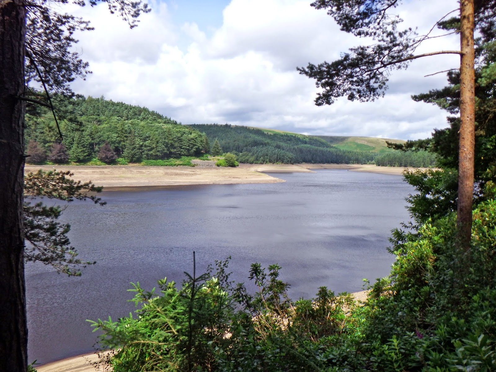
At the upper end of the Howden Reservoir, the tall trees disappeared. Disturbingly though, young trees are now growing along the valley floor. It won't be too many years before these trees too begin to obstruct the view.

I was not sure where to cross the river to commence my southerly walk along the western side of the valley. I noticed a stile in the valley below so, assuming it was there for a purpose, I crossed it and headed down to the river. Sure enough, there were stones in the river bed which enabled a dry crossing of the waters. This view is looking back across the valley, with Upper Hey and Cold Side Clough in the background.

By now, the day was very hot and sunny. I was glad of the shade the wooded slopes offered.

The pathway on this side of the valley quickly becomes a road. On summer Sundays, this is closed to most traffic, when a bus service is provided for hikers and cyclists. The bus passed me three times on the walk down the valley, but I promise I was not tempted to catch it!
The longest side valley on the western side is that of the River Westend. The road heads quite a long way up this valley before crossing by a bridge. There was quite a strong wing coming down these side valleys. The cool breeze was very welcome as it cooled me down - but the headwind when heading west did make walking just a bit of a challenge!

From the southern side of the mouth of the Westend Valley, I had one last look up the Derwent Valley to the north.

From here, I soon reached the Howden Dam again.

South of the dam was the temporary village of Birchinlee, erected for the workers building the Derwent and Howden Dams. I passed a monument to the village, seen here below. There were also several information boards.

The Derwent Dam came next. There is a small museum in the west tower.

This board gave a useful indication of water capacity and levels in each reservoir.

Here is the entrance to the museum, along the top of the dam wall.

Just beyond the dam is the Fairholmes Visitor Centre. From here, I left the waterside and climbed steeply up the hillside, through the woods towards Lockerbrook. The view would have been really stunning from here - but for all the trees! You can just make out one of the reservoirs in the valley, far below.

Higher up, the woodland cleared and the land flattened out, giving longer views across the summits of the hills. This one is looking back down the route I had come, to the east.

At the top of the climb, the path joins a bridleway from Ouzleden Clough to Hagg Farm and the A57 main road. I turned left along this bridleway past Lockerbrook Farm. The route is fairly flat for some distance, before the steep descent to the A57. Here is a view looking towards the Snake Pass, from the top of the descent.

I crossed the main road and continued my descent to Haggwater Bridge, crossing the River Ashop. This is just west of the head of the Ashop Valley arm of the Ladybower Reservoir. I then began another very steep climb through some beautiful woodland towards Hope Cross.

I stopped halfway up the climb to catch my breath. The sunlight glinting through the trees was very beautiful.

At the top of the climb, I reached the crossroads to the rest of the world. It was sharp left to Hope Cross and Win Hill, which can be seen in the far distance, to the left of the signpost.

The track partly follows the route of a Roman Road along the ridge. Win Hill seems to have this amazing property of looking further away, the closer you get to it! Here it is again!

Hope Cross is an interesting monument. The top is square. Each side is inscribed with a destination - Edale, Glossop, Hope and Sheffield. The monument is about 7 feet high.

Beyond Hope Cross, the views to the south and east are stunning, though difficult to photograph in the late afternoon on a sunny day. Here is the view south west towards Nether Moor, Edale Moor and Kinder Scout.

Further to the south is Edale.

Before long, views begin to open up to the north east. Here, you can just see the Ladybower Reservoir far below.

Here is a view of Bradwell Dale, with Shatton Moor to the left and the cement factory very prominent on the right.

Finally, the peak of Win Hill suddenly seemed a lot closer!

From the top, the views are very good, especially on a clear day like this. Looking to the north, the twin arms of the Ladybower Reservoir were very clear, with Crook Hill in-between. Derwent Moors, Back Tor and Dovestone Tor are on the right.

The eastern end of the reservoir is visible here, close to where I began my walk. The only challenge now was to get down there, safe and well, before the bus left for home. It is around 260 metres from the top of Win Hill to the valley floor.

I used the direct footpath down towards Yorkshire Bridge. This is very steep, with prominent tree branches and loose rocks to contend with. Here is the proof that I reached the bottom!

I then turned left towards the Ladybower Dam. Beyond the Dam, on the other side of the valley is Bamford Edge.

Here is a view down the Derwent Valley from the dam itself. Unlike the masonry of the other two dams, the Ladybower Dam wall is an earthen structure.

Here is a view looking north from the dam, towards the A57 junction.

I turned left along the main road on the other side of the dam and retraced my steps to the A57 main road. Here, I turned right to reach the Ladybower Inn, where the main group was enjoying the refreshments and the sunshine. They had arrived around half an hour before me. I did not feel too ashamed though, as I had covered nearly twice the distance.
Many thanks again to the Sutton-in-Ashfield Ramblers for allowing me the opportunity to do such a wonderful walk. It was really exhilarating!
I went round anticlockwise. This offered more options if I were running late towards the end of the walk. I followed the eastern bank of the northern arm of the Ladybower Reservoir. I continued north beyond the other two reservoirs, then back down the western side of the valley. From the Fairholmes Visitor Centre, I more or less followed the route of the main party, but in reverse. I turned west up the steep hillside to Lockerbrook and Hagg Farm. I then descended to the A57 road before ascending to Hope Cross. From here, I followed the ridge east to Win Hill before descending to the Ladybower Reservoir dam. I finished the walk at the Ladybower Inn, around half-an-hour after the main group had arrived.
The walk began at the Heatherdene Car Park, by the side of the Ladybower Reservoir. I headed north along the adjacent main road. The sky was a little gloomy at this early stage in my walk, but much of the cloud quickly disappeared to give a bright, hot, sunny day. Ashopton Viaduct was visible in the distance, where the A57 crosses the Derwent Valley arm of the reservoir.
The water disguises the true depth of the viaduct. Here is a photo of it during construction, with the soon-to-be-demolished village of Ashopton below.
I turned left onto the A57, then crossed the road and headed up a trackway along the eastern side of the reservoir. The view up the Upper Derwent Valley was very beautiful and inviting.
Here is a view looking back to the south, with the Ashopton Viaduct in the distance. Win Hill is visible behind the viaduct. This summit would be the last major challenge of my walk, late in the afternoon.
Much of the steeply-sided valley is heavily wooded, obstructing the views of the reservoirs and the landscapes generally. The trees did provide some welcome shade from the sun though, as the day got warmer. The paths along both sides of the valley are of high quality, suitable for cycling as well as walking.
Occasionally, the view did open out, as here, not far south of the site of Derwent Village.
Most of Derwent Village was demolished and the site flooded when the Ladybower Reaservoir was built. There are a few remains, like this gateway oddly placed in what is now the middle of a field.
An information board gives some details of the old village, including this photo taken just as the buildings were being demolished.
The gate pillars for the old vicarage can be seen on the left of this photo.
Beyond here, a few other structures remain, including the old school house and this postbox.
The head of the Ladybower Reservoir has a small wooded area, seen here in the distance, before the dam for the Derwent Reservoir.
Here is a view of the Derwent Dam, taken from just upstream.
Beyond the dam, the Derwent Reservoir and the Upper Derwent Valley continues through the landscape.
There are a few smaller side valleys, including this one on the western side, at Ouzleden Clough.
The Derwent Reservoir was less than full, as shown here, at the head of the reservoir. One of the towers of the Howden Dam is visible through the trees.
The water level in the Howden Reservoir was much lower than in the two previous reservoirs, as evidenced by the "beaches" all the way along its shores. This part of the valley is heavily wooded.
At the upper end of the Howden Reservoir, the tall trees disappeared. Disturbingly though, young trees are now growing along the valley floor. It won't be too many years before these trees too begin to obstruct the view.
I was not sure where to cross the river to commence my southerly walk along the western side of the valley. I noticed a stile in the valley below so, assuming it was there for a purpose, I crossed it and headed down to the river. Sure enough, there were stones in the river bed which enabled a dry crossing of the waters. This view is looking back across the valley, with Upper Hey and Cold Side Clough in the background.
By now, the day was very hot and sunny. I was glad of the shade the wooded slopes offered.
The pathway on this side of the valley quickly becomes a road. On summer Sundays, this is closed to most traffic, when a bus service is provided for hikers and cyclists. The bus passed me three times on the walk down the valley, but I promise I was not tempted to catch it!
The longest side valley on the western side is that of the River Westend. The road heads quite a long way up this valley before crossing by a bridge. There was quite a strong wing coming down these side valleys. The cool breeze was very welcome as it cooled me down - but the headwind when heading west did make walking just a bit of a challenge!
From the southern side of the mouth of the Westend Valley, I had one last look up the Derwent Valley to the north.
From here, I soon reached the Howden Dam again.
South of the dam was the temporary village of Birchinlee, erected for the workers building the Derwent and Howden Dams. I passed a monument to the village, seen here below. There were also several information boards.
The Derwent Dam came next. There is a small museum in the west tower.
This board gave a useful indication of water capacity and levels in each reservoir.
Here is the entrance to the museum, along the top of the dam wall.
Just beyond the dam is the Fairholmes Visitor Centre. From here, I left the waterside and climbed steeply up the hillside, through the woods towards Lockerbrook. The view would have been really stunning from here - but for all the trees! You can just make out one of the reservoirs in the valley, far below.
Higher up, the woodland cleared and the land flattened out, giving longer views across the summits of the hills. This one is looking back down the route I had come, to the east.
At the top of the climb, the path joins a bridleway from Ouzleden Clough to Hagg Farm and the A57 main road. I turned left along this bridleway past Lockerbrook Farm. The route is fairly flat for some distance, before the steep descent to the A57. Here is a view looking towards the Snake Pass, from the top of the descent.
I crossed the main road and continued my descent to Haggwater Bridge, crossing the River Ashop. This is just west of the head of the Ashop Valley arm of the Ladybower Reservoir. I then began another very steep climb through some beautiful woodland towards Hope Cross.
I stopped halfway up the climb to catch my breath. The sunlight glinting through the trees was very beautiful.
At the top of the climb, I reached the crossroads to the rest of the world. It was sharp left to Hope Cross and Win Hill, which can be seen in the far distance, to the left of the signpost.
The track partly follows the route of a Roman Road along the ridge. Win Hill seems to have this amazing property of looking further away, the closer you get to it! Here it is again!
Hope Cross is an interesting monument. The top is square. Each side is inscribed with a destination - Edale, Glossop, Hope and Sheffield. The monument is about 7 feet high.
Beyond Hope Cross, the views to the south and east are stunning, though difficult to photograph in the late afternoon on a sunny day. Here is the view south west towards Nether Moor, Edale Moor and Kinder Scout.
Further to the south is Edale.
Before long, views begin to open up to the north east. Here, you can just see the Ladybower Reservoir far below.
Here is a view of Bradwell Dale, with Shatton Moor to the left and the cement factory very prominent on the right.
Finally, the peak of Win Hill suddenly seemed a lot closer!
From the top, the views are very good, especially on a clear day like this. Looking to the north, the twin arms of the Ladybower Reservoir were very clear, with Crook Hill in-between. Derwent Moors, Back Tor and Dovestone Tor are on the right.
The eastern end of the reservoir is visible here, close to where I began my walk. The only challenge now was to get down there, safe and well, before the bus left for home. It is around 260 metres from the top of Win Hill to the valley floor.
I used the direct footpath down towards Yorkshire Bridge. This is very steep, with prominent tree branches and loose rocks to contend with. Here is the proof that I reached the bottom!
I then turned left towards the Ladybower Dam. Beyond the Dam, on the other side of the valley is Bamford Edge.
Here is a view down the Derwent Valley from the dam itself. Unlike the masonry of the other two dams, the Ladybower Dam wall is an earthen structure.
Here is a view looking north from the dam, towards the A57 junction.
I turned left along the main road on the other side of the dam and retraced my steps to the A57 main road. Here, I turned right to reach the Ladybower Inn, where the main group was enjoying the refreshments and the sunshine. They had arrived around half an hour before me. I did not feel too ashamed though, as I had covered nearly twice the distance.
Many thanks again to the Sutton-in-Ashfield Ramblers for allowing me the opportunity to do such a wonderful walk. It was really exhilarating!
Tuesday 29 July 2014
W/C 26th July 2014 - Ogston, Cocking Tor, High Oredish and Brackenfield
I have passed through Higham a few times on my walks - usually on my way home and feeling very tired. On the west side of the A61, more or less opposite the Greyhound pub, is this intriguing gateway.

The sign reads:-
Beyond the bottom of the valley and Ogston Reservoir, I had no idea where I might go. This made the surprise even more pleasing, as I stumbled across some very beautiful, remote countryside between Ogston Reservoir and Ashover. The area includes spectacular viewpoints.
The overall route eventually took the form of a figure of eight, with a very small amount of duplication around Higham on the outward and return journeys - not entirely disconnected to the attractions of The Greyhound pub. Well - it was a hot thirsty day! The overall distance was around 30 miles.
Starting from home, I headed west along the A38 main road before north turning down Rookery Lane towards Huthwaite. The walk was continued via a footpath over an old colliery tip to the bottom end of Mill Lane.
The top of the climb provides a tempting view of the Derbyshire hills in the far distance.

I then followed the Blackwell Trail to Westhouses.

As I approached Westhouses on the recently-opened western end of the trail, the Derbyshire hills looked just that little bit closer.

From Westhouses, I followed the country lane north to Shirland, passing the church just after I reached the main road through the village.

From Shirland, it is but a short walk along the A61 main road to Higham, where the gateway awaited me....

Higham stands on a ridge high above the Amber Valley. This is the view to the south, from the top.

Ogston Reservoir quickly comes into view. This lane also gives a rare view of Ogston Hall, seen just to the left of the reservoir. From most angles, the Hall is shrouded by trees.

Near the bottom of the hill, the lane crosses the main Chesterfield to Derby railway line. For once, a train turned up at a railway crossing place just at the right time.

Looking back, the ridge on which Higham sits was still visible - but not for long.

The lane continues straight on into the grounds of Ogston Hall, which has no public access.

The public bridleway turns right for a short distance through some rather ugly buildings owned by the water company that owns the reservoir, before joining a very narrow country road called Hurst Lane. I turned left at the junction, taking the route closest to the reservoir You do get a fleeting glimpse of the dam wall. There is no footpath along the waterfront.

The lane gradually descends to the north end of the reservoir. At first, the bank of the reservoir is filled with a thick blanket of trees. Gradually, this thins out to provide at least a glimpse of Ogston Reservoir.

The lane joins the main B6014 road. I turned west at the junction, following the edge of the reservoir. The water was full of sailing craft.

Just beyond the turn to Woolley, I took a footpath north west along the upper Amber Valley towards Milltown.

The path eventually turned into a trackway, joining a minor road near Dalebank, seen here near the bottom of the valley.

I carried on along a quiet country lane to Milltown, turning left along a narrow lane in front of the Miner's Arms public house. This lane turned west, gradually climbing up a narrow side valley towards Ravensnest. This area was very quiet - not a soul or a car in sight anywhere! To the west and north west, the wooded slopes of Cocking Tor were very evident. I would soon be climbing this escarpment.

I turned right onto a footpath leading to Overton Hall. Looking back, the steep hill at Ashover Hay was visible in the distance.

Overton Hall is difficult to see from the path. This is the best view I could get of the buildings, which are shrouded in trees and stone walls.

Just north of the Hall, I turned left onto the path leading south to Ravensnest, up the side of Cocking Tor. This was my last glimpse of the Hall and surrounding buildings.

The path south is well engineered, climbing gradually through the trees. The lower end is provided with paving stones.

Near the summit, the woodland suddenly opens out into a clearing. Quarrying and mining were carried out here in the past. From this angle, it didn't look particularly attractive!

I quickly realised the benefit of having a clearing in the trees though - the views here are magnificent! This was my first glimpse of the hills to the south.

Only a short distance further on, there was a far more panoramic view. I could clearly see Hardwick Hall in the far distance.

Further up the climb, Bolsover Castle was also visible - though both it and Hardwick are just small specks on the photographs.
Rather than follow the footpaths, I decided to fast track along roads towards Brackenfield. The approach to Butterley was along a shallow valley.

The viewpoint at High Oredish was well worth a long pause to study the panoramic view.

This view is looking north towards the north end of the Amber Valley and Ashover.

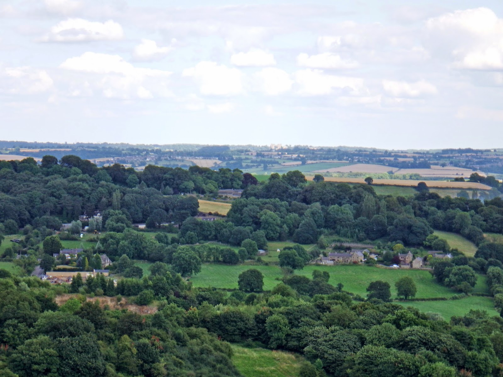
To the east, Ogston Reservoir was clearly visible below, along with Bolsover Castle, and Hardwick Hall in the far distance.

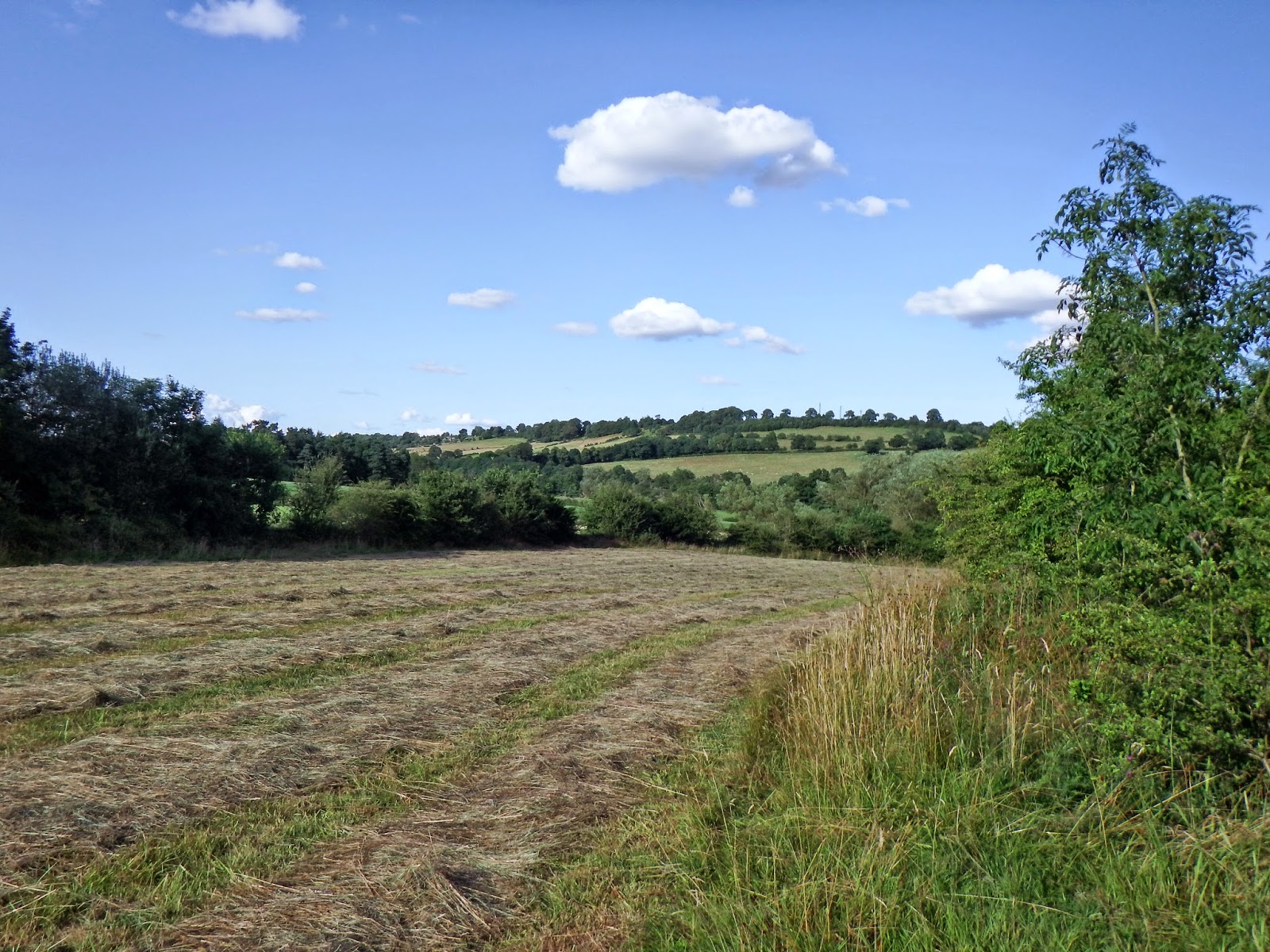
A little further down the lane there is also a view to the south, with Charnwood Forest visible on the distant horison.

I descended to Brackenfield, which has a large village green. This pump and trough are a reminder of the means of water supply in the old days.

The most impressive building on the green is the former school and schoolhouse.

Brackenfield church is a long way down the lane from the village.

From the church, I carried on along a minor road to the east, before turning onto a footpath in the direction of Higham, clearly visible on the ridge in the distance.

The footpath passed through a couple of fields before I reached the railway line again. I saw a fox quite close by at this pint - but it hid in a hedgerow before I could get the camera out.
I began the climb up to Higham village - steady at first but steeper towards the top. I took one last view back across the valley.
 From Higham, I decided to take a more northerly route than that taken in the morning on the way out. There are no suitable footpaths, so I followed a narrow country lane to Morton. Here is the church.

Beyond Morton, I turned south towards Blackwell, along Love Lane. Here is the view south towards Westhouses.

This lane provides a convenient link to the Silverhill Trail, which I would take as far as Huthwaite.

Here is Newtonwood Lane bridge with the M1 motorway bridge just beyond.

I am only sorry that I have not explored the countryside west of Ogston Reservoir before now. The countryside is very beautiful and the views are magnificent. I am sure I will be back before too long!
The sign reads:-
PRIVATE DRIVE
TO OGSTON HALL
NO RESERVOIR TRAFFIC
OGSTON HALL ESTATE
There is also a very inviting Public Bridleway sign pointing down the lane. I finally decided to explore further.
The overall route eventually took the form of a figure of eight, with a very small amount of duplication around Higham on the outward and return journeys - not entirely disconnected to the attractions of The Greyhound pub. Well - it was a hot thirsty day! The overall distance was around 30 miles.
Starting from home, I headed west along the A38 main road before north turning down Rookery Lane towards Huthwaite. The walk was continued via a footpath over an old colliery tip to the bottom end of Mill Lane.
The top of the climb provides a tempting view of the Derbyshire hills in the far distance.
I then followed the Blackwell Trail to Westhouses.
As I approached Westhouses on the recently-opened western end of the trail, the Derbyshire hills looked just that little bit closer.
From Westhouses, I followed the country lane north to Shirland, passing the church just after I reached the main road through the village.
From Shirland, it is but a short walk along the A61 main road to Higham, where the gateway awaited me....
Higham stands on a ridge high above the Amber Valley. This is the view to the south, from the top.
Ogston Reservoir quickly comes into view. This lane also gives a rare view of Ogston Hall, seen just to the left of the reservoir. From most angles, the Hall is shrouded by trees.
Near the bottom of the hill, the lane crosses the main Chesterfield to Derby railway line. For once, a train turned up at a railway crossing place just at the right time.
Looking back, the ridge on which Higham sits was still visible - but not for long.
The lane continues straight on into the grounds of Ogston Hall, which has no public access.
The public bridleway turns right for a short distance through some rather ugly buildings owned by the water company that owns the reservoir, before joining a very narrow country road called Hurst Lane. I turned left at the junction, taking the route closest to the reservoir You do get a fleeting glimpse of the dam wall. There is no footpath along the waterfront.
The lane gradually descends to the north end of the reservoir. At first, the bank of the reservoir is filled with a thick blanket of trees. Gradually, this thins out to provide at least a glimpse of Ogston Reservoir.
The lane joins the main B6014 road. I turned west at the junction, following the edge of the reservoir. The water was full of sailing craft.
Just beyond the turn to Woolley, I took a footpath north west along the upper Amber Valley towards Milltown.
The path eventually turned into a trackway, joining a minor road near Dalebank, seen here near the bottom of the valley.
I carried on along a quiet country lane to Milltown, turning left along a narrow lane in front of the Miner's Arms public house. This lane turned west, gradually climbing up a narrow side valley towards Ravensnest. This area was very quiet - not a soul or a car in sight anywhere! To the west and north west, the wooded slopes of Cocking Tor were very evident. I would soon be climbing this escarpment.
I turned right onto a footpath leading to Overton Hall. Looking back, the steep hill at Ashover Hay was visible in the distance.
Overton Hall is difficult to see from the path. This is the best view I could get of the buildings, which are shrouded in trees and stone walls.
Just north of the Hall, I turned left onto the path leading south to Ravensnest, up the side of Cocking Tor. This was my last glimpse of the Hall and surrounding buildings.
The path south is well engineered, climbing gradually through the trees. The lower end is provided with paving stones.
Near the summit, the woodland suddenly opens out into a clearing. Quarrying and mining were carried out here in the past. From this angle, it didn't look particularly attractive!
I quickly realised the benefit of having a clearing in the trees though - the views here are magnificent! This was my first glimpse of the hills to the south.
Only a short distance further on, there was a far more panoramic view. I could clearly see Hardwick Hall in the far distance.
Further up the climb, Bolsover Castle was also visible - though both it and Hardwick are just small specks on the photographs.
Rather than follow the footpaths, I decided to fast track along roads towards Brackenfield. The approach to Butterley was along a shallow valley.
The viewpoint at High Oredish was well worth a long pause to study the panoramic view.
This view is looking north towards the north end of the Amber Valley and Ashover.
To the east, Ogston Reservoir was clearly visible below, along with Bolsover Castle, and Hardwick Hall in the far distance.
A little further down the lane there is also a view to the south, with Charnwood Forest visible on the distant horison.
I descended to Brackenfield, which has a large village green. This pump and trough are a reminder of the means of water supply in the old days.
The most impressive building on the green is the former school and schoolhouse.
Brackenfield church is a long way down the lane from the village.
From the church, I carried on along a minor road to the east, before turning onto a footpath in the direction of Higham, clearly visible on the ridge in the distance.
The footpath passed through a couple of fields before I reached the railway line again. I saw a fox quite close by at this pint - but it hid in a hedgerow before I could get the camera out.
I began the climb up to Higham village - steady at first but steeper towards the top. I took one last view back across the valley.
Beyond Morton, I turned south towards Blackwell, along Love Lane. Here is the view south towards Westhouses.
This lane provides a convenient link to the Silverhill Trail, which I would take as far as Huthwaite.
Here is Newtonwood Lane bridge with the M1 motorway bridge just beyond.
I am only sorry that I have not explored the countryside west of Ogston Reservoir before now. The countryside is very beautiful and the views are magnificent. I am sure I will be back before too long!
Subscribe to:
Posts (Atom)