Every year, the Sutton Ramblers do one longer walk of around 20 miles. This traverses the Pennines from the Holmfirth area of Yorkshire, down to Edale in Derbyshire. It traverses extensive areas of moorland, crosses two major Pennine passes and goes through the spectacular scenery around Kinder Scout, before finishing in the beautiful surroundings of Edale village.
This was my first opportunity to partake in the Long Walk, which I had been quite excited about for some time. My enthusiasm was severely tempered though, when I acquired a severe cold, cough and sore throat - with only one day to go before the walk! Despite feeling really ill, I decided to be brave and give it a try. I was very glad I did, but breathing problems, fever and a severe lack of energy made it far, far more challenging than I could ever have anticipated.
The journey began with a very early start, leaving the Ashfield area on a mini-bus around 6am. We reached the Holmfirth area around 7am and headed west along the A635 to Wessenden Head, where we left the mini-bus behind and began our walk south.
The day began very promisingly, with sunshine seeping through the early morning mist. This was the view from the start of our walk, looking east. Digley Reservoir is in the far distance.
As we left the main road, we headed more or less southwards. The route ahead seemed pretty clear, along the Pennine Way.
We crossed a couple of steep gullies early on, in beautiful bright sunshine....
...then headed on over wild, open moorland.
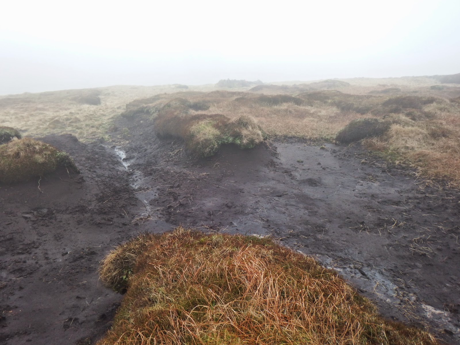
Unfortunately, the mist quickly closed in, followed by fine rain which plagued us for much of the trip. This is a close-up of the peat moorland as we approached Black Hill and Soldier's Lump.
Beyond Soldier's Lump, we left the Pennine Trail and steered a course south towards Westend Moss.
It was difficult to see very far and photography was almost futile!
Eventually, we came over the edge of Westend Moss and began the descent towards Crowden, just below the Woodhead Pass. The mist lifted a little and Torside Reservoir came into view in the far distance.
A little closer - and the weather was definitely clearing up a bit!
This was the view back towards Westend Moss, with Crowden Little Moor on the left. In the valley below is Crowden Little Brook.
We descended through a large old quarry.
Torside Reservoir was now clearly visible to the west.
To the east (above) Woodhead Reservoir was also close by. Beyond the reservoir, the A6124 climbs steeply to the Woodhead Pass.
This was the view back to the north, just before we arrived at the main road.
We made a brief stop for refreshments at Crowden before crossing the A6124 and heading towards the far side of the valley.
We crossed the outfall of the Woodhead Reservoir....
...before joining the Trans Pennine Trail for a short distance to the southwest.
We then took a sharp left up Wildboar Clough towards Bleaklow.
The climb here was very steep, over wet, mossy rocks.
The valley became steeper and narrower as we approached the waterfall near the top.
The very wet conditions had made the climb along the valley floor a little treacherous. Eventually, the going got too tough for many of the group, so we climbed the side of the valley onto the top of the ridge.
Looking back, the view was tremendous - a great excuse for a breather! This view to the west shows Torside Reservoir, with Rhodeswood Reservoir in the distance. Hadfield is shrouded in mist at the far end of the valley.
This view is north over Torside Reservoir, showing the country we had traversed earlier.
Eventually, we rejoined the Pennine Way as we headed south towards the Snake Pass.
Here is a view southeast as we approached the Snake Pass. The dip in the distance leads down eventually to the Ladybower Reservoir.
From the main road, this was the view back along the Pennine Way towards the north.
We continued along the Pennine Way, which skirts the western side of Black Ashop Moor. The weather was very changeable. To the west, Manchester was briefly visible in the far distance on a few occasions.
The route was quick and easy along this stretch, as the path is paved and relatively flat. We shortly reached Mill Hill, where a path to Hayfield branches off.
We turned south east, up Ashop Head and onto the southern edge of Kinder Scout.
This is a view towards Hadfield from a higher elevation.
...and here, a view east towards Kinder Reservoir from near the Kinder Downfall.
The path took a sharp turn to the south as we headed in the general direction of Edale Cross. At one stage beyond here, we were briefly engulfed in mist, with visibility of only a hundred metres or so.
Thankfully, the mist eventually cleared. At Edale Cross, the Pennine Way turns east towards Jacob's Ladder and the Vale of Edale. This view is looking towards Edale from the bottom of Jacob's Ladder.
Finally, the village of Edale became visible in the distance. By now, it was getting dark quite quickly. This is a slightly shaky shot, taken in poor light as we neared the end of the walk.
We reached Edale village just as it got dark
I don't remember for a very long time feeling so exhausted at the end of a walk. My illness had really taken its toll. There had been times when I felt I could hardly walk a step further - a very rare, if not unique feeling for me - yet I had made it to the very end!
The regulars on this annual walk assure me that we had been very unlucky with the weather. Even so, we saw some spectacular scenery. Many thanks to Ian and the Sutton-in-Ashfield Ramblers for organising everything. I am really glad I went on the walk!