
The sign reads:-
PRIVATE DRIVE
TO OGSTON HALL
NO RESERVOIR TRAFFIC
OGSTON HALL ESTATE
There is also a very inviting Public Bridleway sign pointing down the lane. I finally decided to explore further.
The overall route eventually took the form of a figure of eight, with a very small amount of duplication around Higham on the outward and return journeys - not entirely disconnected to the attractions of The Greyhound pub. Well - it was a hot thirsty day! The overall distance was around 30 miles.
Starting from home, I headed west along the A38 main road before north turning down Rookery Lane towards Huthwaite. The walk was continued via a footpath over an old colliery tip to the bottom end of Mill Lane.
The top of the climb provides a tempting view of the Derbyshire hills in the far distance.

I then followed the Blackwell Trail to Westhouses.

As I approached Westhouses on the recently-opened western end of the trail, the Derbyshire hills looked just that little bit closer.

From Westhouses, I followed the country lane north to Shirland, passing the church just after I reached the main road through the village.

From Shirland, it is but a short walk along the A61 main road to Higham, where the gateway awaited me....

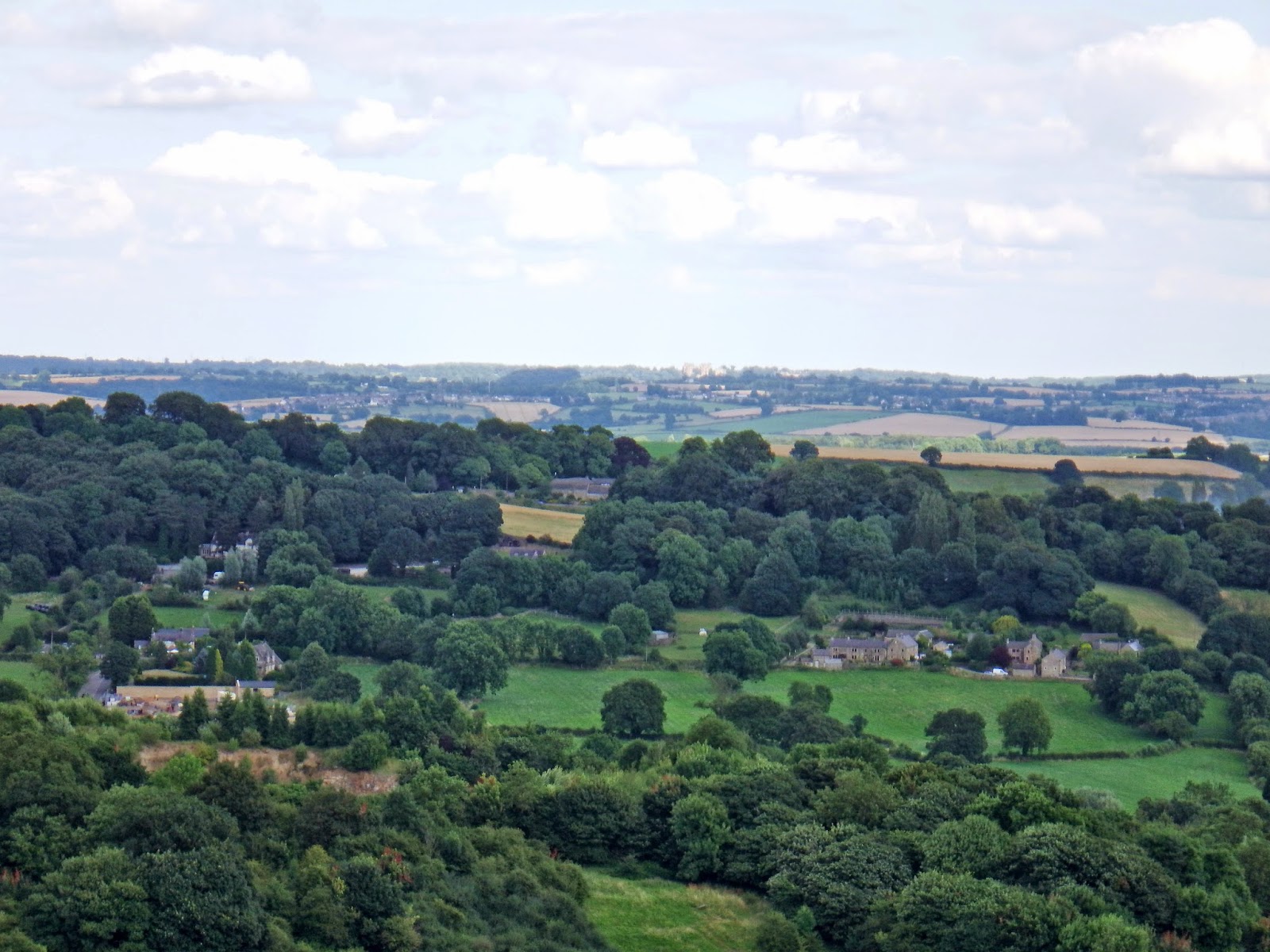
Higham stands on a ridge high above the Amber Valley. This is the view to the south, from the top.

Ogston Reservoir quickly comes into view. This lane also gives a rare view of Ogston Hall, seen just to the left of the reservoir. From most angles, the Hall is shrouded by trees.

Near the bottom of the hill, the lane crosses the main Chesterfield to Derby railway line. For once, a train turned up at a railway crossing place just at the right time.

Looking back, the ridge on which Higham sits was still visible - but not for long.

The lane continues straight on into the grounds of Ogston Hall, which has no public access.

The public bridleway turns right for a short distance through some rather ugly buildings owned by the water company that owns the reservoir, before joining a very narrow country road called Hurst Lane. I turned left at the junction, taking the route closest to the reservoir You do get a fleeting glimpse of the dam wall. There is no footpath along the waterfront.

The lane gradually descends to the north end of the reservoir. At first, the bank of the reservoir is filled with a thick blanket of trees. Gradually, this thins out to provide at least a glimpse of Ogston Reservoir.

The lane joins the main B6014 road. I turned west at the junction, following the edge of the reservoir. The water was full of sailing craft.

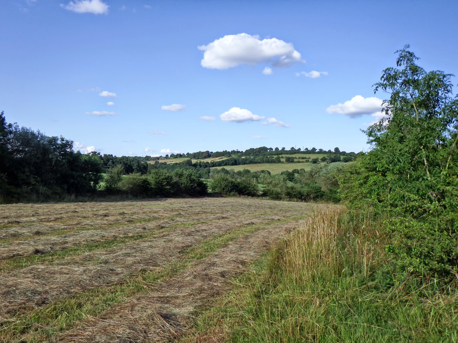
Just beyond the turn to Woolley, I took a footpath north west along the upper Amber Valley towards Milltown.

The path eventually turned into a trackway, joining a minor road near Dalebank, seen here near the bottom of the valley.

I carried on along a quiet country lane to Milltown, turning left along a narrow lane in front of the Miner's Arms public house. This lane turned west, gradually climbing up a narrow side valley towards Ravensnest. This area was very quiet - not a soul or a car in sight anywhere! To the west and north west, the wooded slopes of Cocking Tor were very evident. I would soon be climbing this escarpment.

I turned right onto a footpath leading to Overton Hall. Looking back, the steep hill at Ashover Hay was visible in the distance.

Overton Hall is difficult to see from the path. This is the best view I could get of the buildings, which are shrouded in trees and stone walls.

Just north of the Hall, I turned left onto the path leading south to Ravensnest, up the side of Cocking Tor. This was my last glimpse of the Hall and surrounding buildings.

The path south is well engineered, climbing gradually through the trees. The lower end is provided with paving stones.

Near the summit, the woodland suddenly opens out into a clearing. Quarrying and mining were carried out here in the past. From this angle, it didn't look particularly attractive!

I quickly realised the benefit of having a clearing in the trees though - the views here are magnificent! This was my first glimpse of the hills to the south.

Only a short distance further on, there was a far more panoramic view. I could clearly see Hardwick Hall in the far distance.

Further up the climb, Bolsover Castle was also visible - though both it and Hardwick are just small specks on the photographs.
Rather than follow the footpaths, I decided to fast track along roads towards Brackenfield. The approach to Butterley was along a shallow valley.

The viewpoint at High Oredish was well worth a long pause to study the panoramic view.

This view is looking north towards the north end of the Amber Valley and Ashover.

To the east, Ogston Reservoir was clearly visible below, along with Bolsover Castle, and Hardwick Hall in the far distance.

A little further down the lane there is also a view to the south, with Charnwood Forest visible on the distant horison.

I descended to Brackenfield, which has a large village green. This pump and trough are a reminder of the means of water supply in the old days.

The most impressive building on the green is the former school and schoolhouse.

Brackenfield church is a long way down the lane from the village.

From the church, I carried on along a minor road to the east, before turning onto a footpath in the direction of Higham, clearly visible on the ridge in the distance.

The footpath passed through a couple of fields before I reached the railway line again. I saw a fox quite close by at this pint - but it hid in a hedgerow before I could get the camera out.
I began the climb up to Higham village - steady at first but steeper towards the top. I took one last view back across the valley.


Beyond Morton, I turned south towards Blackwell, along Love Lane. Here is the view south towards Westhouses.

This lane provides a convenient link to the Silverhill Trail, which I would take as far as Huthwaite.

Here is Newtonwood Lane bridge with the M1 motorway bridge just beyond.

I am only sorry that I have not explored the countryside west of Ogston Reservoir before now. The countryside is very beautiful and the views are magnificent. I am sure I will be back before too long!


 op
op


