Thursday 25 July 2013

W/C 20 July 2013 Hathersage to Baslow

The very hot, humid weather over the last 2 weeks made long walks very challenging. Fortunately, it cooled down a little in the last few days, so I joined the Sutton-in-Ashfield Ramblers on another walk in Derbyshire.This time, we did a walk from Hathersage to Baslow. The first half was very similar to the second half of the walk a fortnight ago - but in very different weather conditions. It was cooler, but visibility was poor, with low cloud and mist obscuring the view for much of the day. I made a couple of small deviations on my own along the way.

We walked along the Derwent Valley from Hathersage to Lead Mills, where we joined the route we had followed a fortnight previously. This is the overcast view from the hillside above the valley as we climbed steeply southwards onto Eyam Moor
 On top, the heather was just beginning to come into flower. The sheep did their best to ignore us.
 The view from Eyam Moor over onto the Derwent Valley was very gloomy today.
 Once we reached the Sir William Hill Road, I left the group and walked north west towards Abney. This was the view over the edge of the moor into Bretton Clough.
I turned south east towards Bretton, passing these attentive sheep near Stanage House.
 Back on the Sir John Hill Road, I headed east again. At the highest point, the mast was largely obscured by low cloud.
 I then turned off the road towards Eyam. This was a misty view of the village from the hill above.
 It was a different world down below, as I passed the Alpaca farm.
 I ate lunch in Eyam churchyard.
 The village was quiet for a Sunday - no doubt the poor weather had put people off having a day out.
 After lunch, I rejoined the group for the climb up onto Middleton Moor. We passed this large quarry just across the main A623 road near Eyam.
 On top of the moor and looking back, we could just make out Eyam village and the spire of the church in the mist.
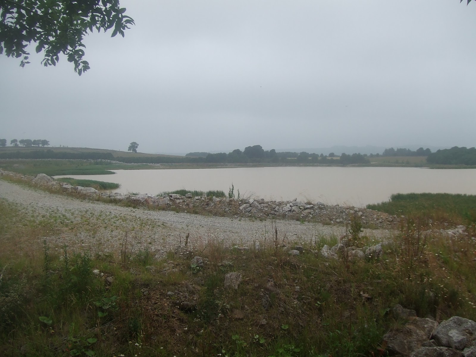
 On top is a man-made reservoir. Not very pretty, to be honest!
 We then descended into Coombs Dale, heading northeast towards Calver. The dale is quite open at the top.
 This is another view from within the dale.
 The dale quickly became wooded, making photography difficult.
 ....and even more woody.......
 .......with just the occasional glimpse of the sides of the dale.........
 ....or not!
 At Calver, I set off on my own again, turning towards the bridge over the Derwent on the A625, just north of the village. This was the view downstream from the bridge.
 I walked downstream along the Derwent Valley Way past Curbar and under the A623. The river was very peaceful here.
 The path leaves the river briefly and climbs a short way up the hillside. This was a view looking north towards Curbar.
 After a short walk along a country lane through Bubnell, I arrived at Baslow. This is a view from the bridge over the Derwent.
Despite the poor visibility, it was an interesting walk, with lots of variety.

Thanks again to the Sutton-in-Ashfield Ramblers for another great walk!

Friday 12 July 2013

W/C 6 July 2013 - (Almost) Circular Walk to Eyam

This week's walk was an almost circular walk in Derbyshire with the Sutton-in-Ashfield Ramblers. It was a very hot, humid day so the group found it quite a struggle. Nevertheless, we saw some very beautiful countryside, with more stunning views. Thanks again to the Sutton Ramblers for another wonderful day out.

A bus took us to the bottom of Eyam Edge, midway between Eyam and Foolow. We then took a path past the Blackhole Mine and up the side of Eyam Edge, heading north west. This is a view of Eyam Edge, looking west.

Here is a view looking south towards the village of Foolow.
We reached the ridge at the hamlet of Bretton. This was a view looking south west from the pub car park.
 We turned north past the pub and headed towards Abney. This was the steep descent down to Bretton Clough.
 After a steep climb the other side of the clough, we passed through fields to Abney. This is a view north over Abney Low.
 Beyond Abney, we turned east, descending into the steeply wooded valley along Abney Clough.
 This view is looking back north eastwards towards Oaks Farm, which is just visible at the top of the hill.
 This was the view in the other direction. Just before the far hills is the Derwent Valley and Hathersage, where we were heading.
 The valley eventually opened out. This is a view looking east. The cliffs in the right background are Millstone Edge.
 On the outskirts of Hathersage, we reached the banks of the River Derwent. This is the view looking downstream towards Millstone Edge.
 After luch, we climbed again steeply out of the valley towards Eyam Moor. This was a view looking back towards Hathersage.
 On the moor, the character of the land changed dramatically. This is a view looking east over the Derwent Valley.
 .. and looking south from a similar viewpoint.
 The sun was glinting off the white seeds of the plant life
 Beyond the moor, we walked west for a short distance along a moorland trackway, before crossing fields to the south, towards Eyam. The hills beyond the Derwent Valley was just about visible in the far distance. We could just make out Chatsworth House in the far distance.
 Finally, we climbed down through woodland to the village of Eyam for a well-earned rest. The edge of the village can just be seen on the right in this photo.
The heat and humidity were almost overpowering at times, particularly on the more exposed sections of the walk. The British are not used to good weather!


Monday 1 July 2013

W/C 29 June 2013 - Misk Hills

The next week or two are a bit hectic, so no chance to do any really long walks. The best I have time for are a few short walks and maybe one a week taking around 6 hours, covering roughly 20 miles. This week, I managed one around the Misk Hills. These are found just north of Hucknall in Nottinghamshire and are a bit of a secret, unless you are local to the area. The M1 motorway goes right over them, just south of Junction 27 - but it is difficult to tell just how interesting this small corner of Nottinghamshire is from the road. It is typical of the kind of walk I do in the winter, when daylight is short.

I began by walking through the Ashfield conurbation to the old part of Kirkby-in-Ashfield. St Wilfrid's church is very ancient. It sits on a small ridge near the head of the Erewash Valley. It is one of several churches in the area that are prominent landmarks - though St Wilfrid's is only clearly visible for any distance from the south and the east. I passed through the churchyard and into the fields beyond, heading south along a footpath towards Portland Park. This is the view of the valley from just south of the churchyard.

 
 Turning my camera to the west, this is a view towards the Derbyshire hills in the far distance.
 After crossing the River Erewash, which is just a tiny stream here, I looked back towards St Wilfrids's church - you can just see the spire sticking up above the trees in the middle of the photo.
 Crossing the railway line, I entered Portland Park, a beautiful piece of woodland. At first sight it seems very natural, maybe even how Sherwood Forest must have looked once upon a time. The whole area was once part of this great forest. Looking more closely, there are plenty of signs of man's activity though, including quarrying and railways. How many people realise, for example, that this embankment (below) was once part of one of the earliest public railways in the world - the Mansfield & Pinxton Railway. It was originally worked by horses.
 Beyond Portland Park, I passed through Kirkby Woodhouse and Annesley before heading for the Misk Hills. I made a small diversion south towards Hucknall to photograph the remains of Annesley Hall - now a derelict hulk. My mother can remember tea parties being held on the once-beautiful terraced lawn.
 The original All-Saints Church in Annesley is at the side of the main road up to the M1 motorway. It too is derelict. It was replaced in the late 19th century by a church in the nearby colliery village.
 Just up the main road from the church is a bridleway leading to the south. I followed this for half a mile or so before turning left towards Hucknall. Just before this path passes under the motorway, the path to Hucknall branches off to the left. It quickly reduces to a narrow path. Most of the woodland around here is artificially planted. There was a serious forest fire here a couple of years ago.
 The forest ends with broad views across the countryside to the south. This one is looking more or less south east towards Hucknall.
 The next shot was taken after I turned east towards the M1. Nottingham is just visible in the distance.
 After crossing the M1 motorway, I continued east towards Moorgreen. Much of this section is along a very narrow tarmac road. It passes the site of Beauvale Priory, though the building is increasingly difficult to see from the road as the trees grow taller. You can just about make the buildings out in the middle of this photo, looking back to the east.
 Another church I passed is Greasley, in the middle of nowhere between several villages. There was once a castle here too.
 At Moorgreen, I followed the Eastwood road for a short way before turning right along a public footpath towards Brinsley. The River Erewash has now turned south in a broad valley, once dominated by ironworks and collieries. This view shows Eastwood church on the east side of the valley and Heanor on the far side, bathed in sunshine.
 I eventually turned back to the northern edge of Moorgreen, passing Moorgreen reservoir. There is no public access to the reservoir, unfortunately. It is reserved for fishing. The reservoir was built as a feeder for the Nottingham Canal, which ran along the Erewash Valley.
 I turned along the footpath back towards Annesley, which runs alongside the reservoir. It is dominated by rhododendron bushes, which are just coming into flower.
 The upper part of the valley the reservoir sits in is very beautiful, spoilt only by the M1 motorway, which runs across its northern rim.
 Felley Priory is on the northern side of the valley. This is now a house and plant nursery. The buildings can be seen here in the middle distance.
 Looking back from where I had come, another prominent church tower is that of Underwood, just seen on the horizon in the middle of the picture. This one really can be seen for miles in most directions.
 On the way back, I passed the old church at Annesley again - this is a view from the main road.
 And a close-up of Annesley Hall showing the state of the building from close up.