Tuesday 29 October 2013

W/C 26th October 2013 - Chatsworth, Beeley Moor, Tupton and the Five Pits Trail

For this walk, I got a bus to Baslow, just north of Chatsworth House in Derbyshire and walked back home. The clocks had been put back an hour overnight, so it was a race against time to get back before it got dark. I made it to the street lights with about half an hour to spare! The distance was around 25 miles.

The route took me through the grounds of Chatsworth House along the Derwent Valley, before turning east, up onto Beeley Moor. I then headed south east across high ground towards Tupton. From here, I headed a short distance north east to the Five Pits Trail, which took me south to Tibshelf. I then turned east along the Teversal Trail.

I hitched a lift with the Sutton in Ashfield Rambling Group as far as Baslow. They were off to Eyam, for a walk back to Baslow. I decided to do my own thing today, as it meant I could do something a little more challenging!

 I crossed the Derwent at Baslow and turned south along the Derwent Valley Heritage Way. This was the view looking back to the old bridge at Baslow.

 I soon entered the grounds of Chatsworth House. Amongst other things, this is famous for some of the work of  Sir Joseph Paxton, designer of the Crystal Palace in London.
 The valley is very pleasant through the park. This is a view looking north towards Baslow.
 Chatsworth House itself is a very impressive landmark in the valley. Here is a view from the south west, after I had crossed the river.
 ...and here is a slightly more distant view. I was soon to turn east and climb the ridge you see to the right of the house.
 I crossed the river again at Calton Lees. Here is the approach to the bridge. The grass was very wet from the recent rains - a warning of ground conditions later in the walk!
 This was my last view of the Derwent, looking south from the bridge.
 I then headed due east, up a narrow road towards Beeley Moor. The climb is about 200 metres. A short way up the hill, I saw my first rainbow of the day, looking north west over Chatsworth House.
 Part way up the hill, there are farm buildings at Beeley Hilltop. From there, the road is a rough track.
This was the view south east towards the Derwent Valley. I took this during a brief shower, as witnessed by the spot of rain on the lens!
 At the top of the hill, I walked along the road from Beeley village, before turning off along a minor road towards Holymoorside.  This was my final view to the west, from the road junction.
 I then took another minor road down a quiet valley to Harewood Grange Farm. This is a view of the farm, looking east from the road.
 From the farm, I took a bridleway east across Harewood Moor. This view shows Harewood Grange Farm from the east.
 Harewood Grange is on the other side of the valley to the farm. This view, looking north, shows the Grange and the valley through to Holymoorside on the right.
 I saw another rainbow (one of several this day) a little later, again looking towards Holymoorside.
 The bridleway took me to Walton Leys Farm, where I experienced a brief, heavy shower. I turned left along the B5057 to the Red Lion Inn at Stone Edge, otherwise known as the Peak Edge Hotel. This interesting rock was on the opposite side of the road.

 Immediately beyond the pub, I turned right (south east) along a footpath towards Tupton. This stretch was by far the most difficult of the walk. The fields were very wet, with standing pools of water and deep mud in places. The route of the path was not at all obvious in parts. Nevertheless, there were some fine views the the east and the north east - and yet more rainbows!
 This shot, from just east of the A632,  shows some of the mud, as well as the view over towards the east.
 And this was a view north to Chesterfield, with the famous crooked spire in the middle of the picture.
 The path eventually came out at Birkin Lane Farm, where I turned left along a minor road for a short distance, then right again along another footpath downhill towards Press. At the minor road to Press, I turned left, heading north towards Bole Hill. At the top of the hill, I reached some thick woodland. I turned right along a path through the southern edge of the woodland (Hardwick Wood). There was another heavy shower here, but I was largely sheltered by the trees. This was the view south from the woods, towards Clay Cross.
 The path through the woods was difficult to follow, as it was hidden by a deep layer of newly-fallen leaves. Fortunately, the path more or less followed the edge of the woods, so it was not difficult to take an educated guess as to where I should go. The path turned east, along the southern edge of the woods, before opening out into fields. This led onto a bridleway to Old Tupton and the A61 road. I briefly turned south at the main road before turning east again at the roundabout. I then took the road east towards North Wingfield. This dips down to the railway line. I crossed the railway and then headed up a steep trackway to the north east. The line of the trackway is shown by the hedgerow in the distance, on this photo taken from the railway bridge.

I think the trackway was once a railway incline leading up to collieries at the top of the hill. This was the view looking back to the west from around halfway up the incline.

 ..and a view of the incline itself, looking downwards from near the top.

 The trackway ends at the northern extreme of North Wingfield. I turned briefly north along the main road, then right, onto a branch of the Five Pits Trail. This is not signposted, but is not difficult to spot from the road!
The Five Pits Trail and its branches are more or less along the trackbeds of old railway lines, so provide a fast, easy way to progress through the countryside. This quickly leads to a junction of the Trail at Wolfie Pond - for once totally devoid of anglers.
 Just south of the pond, I took this shot, looking north west towards Chesterfield.
 The weather was very changeable though! The beautiful blue sky soon darkened to give another heavy shower near Pilsley. To the east, Crich Stand was just visible in the middle of this shot.
 The Five Pits Trail ends just south of Tibshelf. Just to prove that I made it there, here is a shot from the end of the trail, looking north.
 From here, I turned east again, along the Teversal Trail. By now, I was aware that it would soon start to get dark. I got to Huthwaite about half an hour before darkness arrived. I decided to leave the trail here, at the Woodend Inn. That way, I could make my journey home under the glow of street lights, all the way. This was my last view of the Teversal Trail, looking east from the bridge next to the Woodend Inn.
I had long fancied doing a walk through Chatsworth Park and up onto Beeley Moor. This walk achieved that - and a lot more. The distance was shorter than many of my long walks, but the muddy section in the middle was very tiring. With darkness arriving just after 5pm, it would have been difficult to walk much further without the aid of street lights. Apart from a couple of heavy showers, the weather was much kinder than had been forecast, too. All in all a very good day!

Sunday 20 October 2013

W/C 19th October 2013 - Long Walk To Derby

For this walk, I set off into new territory  via Eastwood, Shipley Park, Smalley, Coxbench and Duffield, then down the River Derwent valley via Darley Abbey to Derby. I reckon my route was just slightly over 30 miles - 10 or so more than the direct route. I was aiming for several specific objectives, so the idea of taking the shortest route was never in my mind.

I wandered down through Kirkby and Annesley, past Annesley Hall and the old Annesley Church, then along footpaths to Moorgreen Reservoir. It was a mild, but slightly foggy morning. Here is the view over towards Underwood from just west of the M1 motorway.


From Moorgreen, I had to walk through Eastwood, home of D H Lawrence. This is not the most beautiful of places, but was more or less unavoidable. Here is the Sun Inn, a major landmark in the town...
...and the church, which is an interesting mixture of old and comparatively modern.
Walking down the hill past the church, I came to the bridge over the A611 at New Eastwood. Bilingual signs appeared as I reached the Derbyshire border........ er......... in Polish?!?
The border of Nottinghamshire with Derbyshire follows the Erewash Valley here. This was the view across the valley towards Derbyshire from just west of the A610 road.
I soon turned west along a bridleway towards Stanton Gate and Chapel Hill on the A6007. I crossed the Erewash, which is paralleled by the Nottingham Canal and the Erewash Canal. I crossed the derelict Nottingham Canal first.
This is the River Erewash.
... and finally, the Erewash Canal, which is in much better shape than the Nottingham Canal at this point. I walked the full length of the Erewash Canal a few years ago.
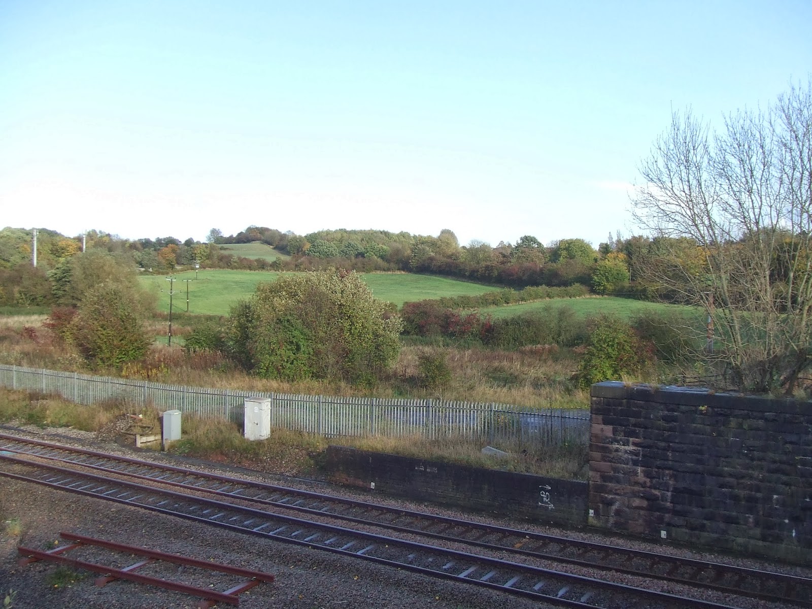
I then crossed the railway line at Shipley Gate. Just as I crossed the footbridge a weedkilling train passed underneath - quite a rare sight!.
This is the view from the footbridge, looking west towards Chapel Hill and the A6007 road.
I followed this bridleway up to the A 6007 and turned left briefly before turning right along the roadway to Chapel Hill Farm. The footpath continues past the farm to Shipley Country Park. The centre of the park was once "The American Adventure", a theme park - now closed and demolished. The lake at the centre of the park is fenced off and hidden behind thick hedging. here is a glimpse through some fencing.
There are other, more accessible lakes in the park though. This one is at the north western end of the park, near Marlpool.
I then walked south to Derby Lodge, where I discovered the Tea Rooms. They serve delicious smoked bacon and sausage cobs (rolls). Guess how I know that!

I  then turned west again from Derby Lodge, along another bridleway towards Smalley.
This is the view as I approached the south end of the village.
I turned left at the main road, then right along a footpath around the southern boundary of Smalley Hall. This opened out into fields, before reaching Woodside. I turned left along the main road through the village. Just past the road to Morley, I turned right onto another footpath and up a steepish hill to the west. Here is a view looking back along the route I had come.
Another steep climb to the top of Marks Hill enabled me to see the hills of the Peak District in the far distance, to the north west.
At Brackley Gate Farm, I took the old bridleway due west towards Duffield. This passed through some beautiful woodland - though some parts were very difficult due to very large puddles and mud from the recent heavy rains.
Leaves were falling, making this part of the walk very colourful.
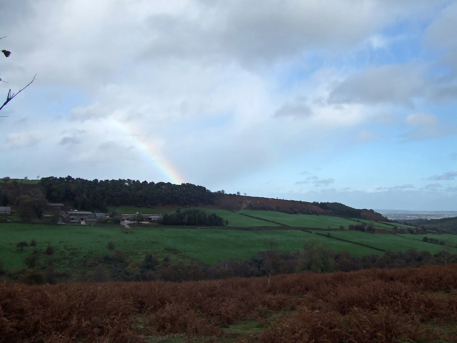
Finally, the view to the north opened out to give this view up the valley northwards towards Coxbench.
By now, I was following the Midshires Way. After passing under the A38, this follows a minor road southwards for a short distance before climbing a steep hill to the west, through woodland.
It then opened out onto flat fields full of mud, cows and cowpats! I was hoping for views of the Derwent Valley, but trees and buildings completely obscured the view as I dropped down into Duffield Bank.
At the Bridge Inn, I finally saw the River Derwent. This is a view north from the bridge.
I then, more or less, followed the Heritage Way Trail south along the Derwent to Derby. This is a view of the houses flanking the river just south of the bridge........
......and another view from slightly further along the route.
The Heritage Way turns up to the main road slightly further along the river, just after passing the site of an old riverside mill. Here is a view from the road, looking south along the valley towards Little Eaton.
Shortly after this, I climbed the hillside and followed another bridleway south in the hope of getting better views of the valley. Instead, there were yet more trees! Still, at least the sun was out.
I dropped down into Little Eaton. Here is the tiny church.
And here is an old building next to the main road through the village.
I then followed the B6179 southwards for a short distance towards Derby. At the roundabout with the A38, I turned west again, briefly, to cross the railway line. I then went down the embankment on the signposted footpath to the right, before turning south under the A38 and along a track which follows the eastern bank of the Derwent. Some of the buildings of Derby soon came into view in the far distance.
The sun was shining on Breadsall church, to the east.
The river winds its way through flat meadowland for a while. This view was looking north west.
Just after some playing fields, I turned west again towards Darley Abbey. This is a toll road, though no one was in the toll booth to collect any money. The road passes through the grounds of some old cotton mill buildings.
I then crossed the bridge over the Derwent. This is the view looking back to the mill buildings and the bridge.
The village of Darley Abbey has one or two very old buildings. This one was once part of the Abbey - though little else survives of the monastic site.
Beyond here is a large park, full of beautiful trees and wide expanses of grass. I climbed the bank up to a footpath leading towards Derby city centre.
This gradually dropped down until I reached the edge of the centre of Derby itself.
Here is the cathedral.
and the old Silk Mill
There was a feeding frenzy just south of the new bus station...
... and a final view towards the city centre as I headed for the railway station.
Shortly after I arrived at Derby station, the skies suddenly went very dark, followed by very heavy rain. I had just got there in time to avoid a thorough soaking! Here I caught a train home, changing trains at Nottingham.

At least I got some good mileage done. Also, I saw a bit of Derbyshire I was not really familiar with at all. All in all not a bad walk, though not as pretty as the Peak District!