Today's walk started on the A619 west of Chesterfield. I headed generally south east past Holymoorside, Stone Edge, Stubbing Pond and Bole Hill to Old Tupton. I then headed down the Five Pits Trail to Tibshelf. Walking past Newton, I headed for the Blackwell Trail, which took me most of the way home. It was a beautiful, sunny day, allowing clear views across the countryside. Mud was everywhere, but who cares when you can still have such a nice day out?
I used the Sutton-in-Ashfield Ramblers' coach to get to my start point. The first half of the walk was more or less the same route that the rest of the group took. I headed off on my own though, as I needed a much longer walk and needed to get a move on to get home before dark. I now have a new battery for my camera, so shooting was much less problematic than on the last few walks. The strong, low sun made many shots very difficult though.
My walk began near Leagrave, heading over fields and through woodland towards Holymoorside. After a short driveway, things quickly got very, very muddy.
This was taken southwards, into the sun towards Holymoorside.
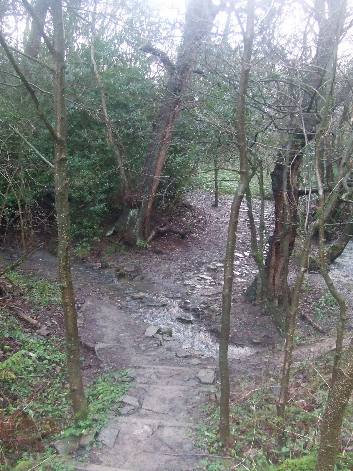
At the junction of two streams, I got a brief chance to was some of the mud off my boots!
I then headed up a steep, slippery path to the lane from Chanderhill to Holymoorside.
At the lane, the sign pointed back along my route so far. Nether Loads is a delightful name!
I soon got my first glimpse of Holymoorside through the trees. The large puddle in the middle of the field shows just how waterlogged everywhere was.
On the outskirts of the village, I turned right along Loads Road and then left along a bridleway due south towards Nabb Quarry.
Looking north east, there were good views of Holymoorside and Chesterfield beyond, gleaming in the sunshine.
The track gradually narrowed as I climbed towards the crest of the hill.
Over the crest, there was an excellent view of the Hipper Valley - though the camera struggled to cope with the scene.
I then followed the path down through the woodland to the road at the bottom.
This view is looking towards Holymoorside.
On the other side of the road, the path continued down to an old waterworks building, almost hidden in the trees.
After crossing a footbridge, I climbed up the other side of the valley through more woodland - and mud!
The path then followed a narrow side valley up towards the B5057 near Stone Edge. This involved crossing a stream usng stepping stones. I almost slipped and fell in! Fortunately, I just managed to keep my balance. Strangely, my efforts to stop slipping translated my forward motion into a rotary motion. I ended up swiveling almost 360 degrees on the spot - a very interesting experience!
Beyond the ford, I continued the climb up the valley.
Just before the main road, I had one last look back towards the Hipper Valley.
The main road was very quiet. Here is a view towards Stone Edge and the Red Lion Inn.
Outside the Red Lion Inn, I stopped briefly for a drink of tea. The sun finally came out for the rest of the day.
Stone Edge is not open to the public as far as I can see. This house is right up against the rock face.
Opposite, there was a long view across the fields towards the south east.
I then crossed the A632. Immediately across the road was a fantastic panoramic view over the countryside, more or less covering my route ahead.
I took the footpath immediately opposite the end of the B5057. As I descended through the fields, the view ahead continued to impress. Wingerworth is on the hill in the middle distance.
After passing Stone Edge Farm, I headed down towards Stubbing Court. The footpath turned into a narrow lane. This moss-covered piece of wall had presumably seen better days!
I noticed that catkins were coming out.
The lane included a ford - fortunately with a footbridge!
The lane headed east below Harper Hill before joining a minor road near Stubbing Court.
I followed this road, which gives a nice view of The Great Pond of Stubbing, as it is called.
This was the best view I could get from the road of Stubbing Court itself, an old manor house.
The pond is man made, with a dam at the eastern end.
The view from the end of the dam was stunning, with beautiful reflections of the sky and the trees in the water.
I then headed east along a paved footpath through the fields towards Bole Hill.
Looking back, there was a small group of buildings near the Pond.
At the top of the first rise on Bole Hill is a memorial stone.
Beyond here, I walked up a minor road past Bole Hill Farm, up towards the woods at the top of the hill. The road offered superb views on either side. This view is to the west, with Stone Edge somewhere up on the right.
The other way, there were long views to the north and the east. Bolsover Castle was clearly visible in the far distance.
This was my last view back towards Chesterfield before the road plunged into woodland.
The road takes a sharp turn to the right just beyond the top of the hill. I carried straight on along a footpath towards Old Tupton. This was part of my path a few months ago when I walked home from Baslow.
Finally, I reached civilisation again at Old Tupton. The main road is at the end of this lane.
I had decided, early on, to head for the Five Pits Trail once I reached Old Tupton, as I didn't think I would reach there so quickly. I wish I had reconsidered my decision, as I could have headed due south towards Ogston Reservoir. Instead, I followed my original plan, towards the railway and up the incline to the north edge of North Wingfield.
At the top of the incline, the crooked spire of Chesterfield is just visible in the centre of this shot.
Wolfie Pond looked very tranquil as I passed.
This little smallholding at North Wingfield is always interesting to pass. I was relieved to see that one turkey, at least, had survived Christmas!
Further south, the sky was still a beautiful blue colour, but the sun was beginning to set. This was the view to the north west, from just south of North Wingfield.
To the east, the landscape is less dramatic, but interesting. This view is just north of Pilsley, with Moorhouse farm hugging the crest of the hill.
At the end of the Five Pits Trail, I turned east for a short way. I had reached this point much earlier than I expected to. The late afternoon was still very pleasant. I didn't want to get home too soon. I headed for the Newton Trail, a short path leading round the western edge of Newton Village.
At the end of the trail, I turned north to the George & Dragon pub and then right towards Blackwell Church. This road has several interesting buildings, including the old Hall, which dates back to at least the 1500s.
There are two thatched cottages along this road too. Here is one of them.
At Blackwell church, I took the footpath leading along the eastern side of the churchyard. This leads down a steep hill, across the road to Hilcote and down to the Blackwell Trail at the bottom of the valley.
The Blackwell Trail is another former railway line. Here is the bridge carrying the M1 over the trail - quite a stark contrast to everything I had seen earlier on my walk..
At the end of the trail, I headed a short distance south on the B6027, then left onto a footpath around the edge of the site of a former colliery. This comes out at the bottom of Rookery Lane, seen here leading up to the A38.
I then followed the main roads home.
It was a really wonderful day for the time of year, a bright, clear, sunny, mild day. Despite the mud, it really was a really interesting walk - particularly the section from the start to Bole Hill, which I had not covered before. My only regret, as I mentioned earlier, was that I didn't have a more ambitious itinerary beyond Bole Hill. I could have covered more countryside that I had not seen before and still got home safe - maybe another time?