A beautiful, clear, sunny day saw me walk from Youlgreave back to my my home. It was around 25 miles. Some of the views were absolutely stunning. I hitched a lift with the Sutton in Ashfield Rambling Group to Youlgreave.
I began at Youlgreave in the Peak District, walking down to the River Bradford, which runs below the village. This was the view looking south east from above the gorge.
... and the view looking up river towards Middleton. The Limestone Way footpath follows the river at this point.
I crossed the river and followed the Limestone Way south east towards Harthill Moor. This was my view of the route ahead.
Looking back, Youlgreave was bathed in beautiful sunshine.
On Harthill Moor, I decided to head for Elton rather than follow the Limestone Way. This is a view of the route I had taken just before reaching Elton village.
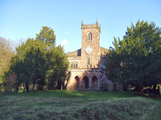
Elton church looked very beautiful in the sunshine.
I turned left past the church and headed along the B5057 eastwards towards the Limestone Way. In this area, the Limestone Way is a trackway. I passed Grey Tor as the trackway headed west of Winster towards the B5056 Bakewell to Ashbourne road.
The sky was quite dramatic in places!
Beyond the main road, I continued along the Limestone Way towards Bonsor. The views along this stretch were really stunning. This is a view looking north over Winster, which is largely hidden in the valley below.
To the east, the Derwent Valley came into view. Darley Dale is in the distance.
A final view of Winster, looking north east.
To the north, I could soon clearly see the Derwent Valley, with Chatsworth House glowing in the sun, in the far distance and Beeley Moor above it - where I had walked only a fortnight before.
This is a panorama of the whole scene. I spent a while here just taking in the view.
By now the trackway had given way to a poorly-signposted footpath across fields. Eventually, a view opened to the south, with Crich in the distance on the hilltop. Crich Stand and the quarry face below it were clearly visible in the far distance.
I took a minor diversion from the Limestone Way towards Bonsall Dale. Here is the upper part of the Dale, just before reaching Upper Town.
At Upper Town, I briefly rejoined the Limestone Way as I headed for Bonsall. The village is shown here, as I approached it from the west. Crich is also visible again on the horison - getting closer, but still a fiar way to go!
Bonsall was very quiet, despite the fantastic weather.
I then left the Limestone Way for good, walking up past the church and onto a footpath around the north side of an old quarry. This is a view looking back over Bonsall and Upper Town towards the north east.
This is a view looking east towards Matlock Bath, which was hidden deep in the valley beyond the trees.
The path eventually descended steeply towards Cromford. This is a view of the village from above.
...and a view of the pond in the centre of the village........
...followed by a view of the main street.
Beyond Cromford, I got my first view of the River Derwent, as I joined the Derwent Valley and headed east towards Cromford wharf.
Cromford church has unusual architecture.
I quickly arrived at Cromford Whaft, the start of the Cromford Canal. This is the view looking back towards Cromford.
From here I followed the Canal towards Whatstandwell. I was lucky to catch a shot of the resident barge as I passed by. Only a very short stretch of the canal is navigable.
The canal passes through open countryside briefly, before plunging into woodland.
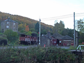
It passes the old workshops of the Cromford and High Peak Railway - now the High Peak Trail.
Shortly afterwards, the canal crosses the River Derwent on an aqueduct.
This ornate pumphouse is at the side of the aqueduct - used in former times to pump water up to the canal.
Just beyond the aqueduct, the woodland starts.
This is also the end of the navigable section. A short stretch here has become silted up.
Looking ahead, Crich was getting much closer on the horizon. I would soon be climbing up the escarpment towards the village.
In the meantime, the canal here is very beautiful as it winds along the side of the Derwent Valley.
There is a short tunnel to negotiate at Lea Wood. This is the north western portal.
Beyond the tunnel, the canal crosses the railway. On the approach to Whatstandwell, I passed this beautiful tree.........
.......... followed by more woodland. The reflections of the trees in the water were really beautiful.
I said goodbye to the canal at Whatstandwell. This is a view of the canal from the bridge as it headed south towards Ambergate.
By now, my objective was to get to Alfreton as quickly as possible, to avoid walking too far in darkness. I followed the main road from Whatstandwell to Crich and South Wingfield. This road has old milestones preserved for posterity.
Crich church and the monument were soon visible - this time far closer than I had seen previously!
This was the panorama looking east from a viewpoint on the approach to the village.
Beyond Crich, the sun was setting fast. The moon was clearly visible in the sky to the south east.
I passed the ruins of Wingfield Manor - looking very threatening in the gloom - on the approach to South Wingfield.
Beyond South Wingfield, I headed for Alfreton - getting there just as it got dark. I had street lights all the way from there. I then followed the main road through South Normanton and across the M1 motorway.
Finally, I headed along the A38 back towards Ashfield.
The stunning views along the way made this a very memorable walk!


No comments:
Post a Comment