For this walk, I set off into new territory via Eastwood, Shipley Park, Smalley, Coxbench and Duffield, then down the River Derwent valley via Darley Abbey to Derby. I reckon my route was just slightly over 30 miles - 10 or so more than the direct route. I was aiming for several specific objectives, so the idea of taking the shortest route was never in my mind.
I wandered down through Kirkby and Annesley, past Annesley Hall and the old Annesley Church, then along footpaths to Moorgreen Reservoir. It was a mild, but slightly foggy morning. Here is the view over towards Underwood from just west of the M1 motorway.
From Moorgreen, I had to walk through Eastwood, home of D H Lawrence. This is not the most beautiful of places, but was more or less unavoidable. Here is the Sun Inn, a major landmark in the town...
...and the church, which is an interesting mixture of old and comparatively modern.
Walking down the hill past the church, I came to the bridge over the A611 at New Eastwood. Bilingual signs appeared as I reached the Derbyshire border........ er......... in Polish?!?
The border of Nottinghamshire with Derbyshire follows the Erewash Valley here. This was the view across the valley towards Derbyshire from just west of the A610 road.
I soon turned west along a bridleway towards Stanton Gate and Chapel Hill on the A6007. I crossed the Erewash, which is paralleled by the Nottingham Canal and the Erewash Canal. I crossed the derelict Nottingham Canal first.
This is the River Erewash.
... and finally, the Erewash Canal, which is in much better shape than the Nottingham Canal at this point. I walked the full length of the Erewash Canal a few years ago.
I then crossed the railway line at Shipley Gate. Just as I crossed the footbridge a weedkilling train passed underneath - quite a rare sight!.
This is the view from the footbridge, looking west towards Chapel Hill and the A6007 road.
I followed this bridleway up to the A 6007 and turned left briefly before turning right along the roadway to Chapel Hill Farm. The footpath continues past the farm to Shipley Country Park. The centre of the park was once "The American Adventure", a theme park - now closed and demolished. The lake at the centre of the park is fenced off and hidden behind thick hedging. here is a glimpse through some fencing.
There are other, more accessible lakes in the park though. This one is at the north western end of the park, near Marlpool.
I then walked south to Derby Lodge, where I discovered the Tea Rooms. They serve delicious smoked bacon and sausage cobs (rolls). Guess how I know that!
I then turned west again from Derby Lodge, along another bridleway towards Smalley.
This is the view as I approached the south end of the village.
I turned left at the main road, then right along a footpath around the southern boundary of Smalley Hall. This opened out into fields, before reaching Woodside. I turned left along the main road through the village. Just past the road to Morley, I turned right onto another footpath and up a steepish hill to the west. Here is a view looking back along the route I had come.
Another steep climb to the top of Marks Hill enabled me to see the hills of the Peak District in the far distance, to the north west.
At Brackley Gate Farm, I took the old bridleway due west towards Duffield. This passed through some beautiful woodland - though some parts were very difficult due to very large puddles and mud from the recent heavy rains.
Leaves were falling, making this part of the walk very colourful.
Finally, the view to the north opened out to give this view up the valley northwards towards Coxbench.
By now, I was following the Midshires Way. After passing under the A38, this follows a minor road southwards for a short distance before climbing a steep hill to the west, through woodland.
It then opened out onto flat fields full of mud, cows and cowpats! I was hoping for views of the Derwent Valley, but trees and buildings completely obscured the view as I dropped down into Duffield Bank.
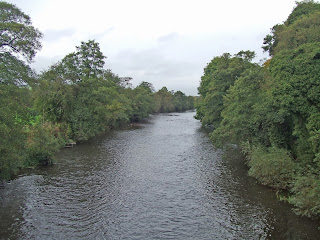
At the Bridge Inn, I finally saw the River Derwent. This is a view north from the bridge.
I then, more or less, followed the Heritage Way Trail south along the Derwent to Derby. This is a view of the houses flanking the river just south of the bridge........
......and another view from slightly further along the route.
The Heritage Way turns up to the main road slightly further along the river, just after passing the site of an old riverside mill. Here is a view from the road, looking south along the valley towards Little Eaton.
Shortly after this, I climbed the hillside and followed another bridleway south in the hope of getting better views of the valley. Instead, there were yet more trees! Still, at least the sun was out.
I dropped down into Little Eaton. Here is the tiny church.
And here is an old building next to the main road through the village.
I then followed the B6179 southwards for a short distance towards Derby. At the roundabout with the A38, I turned west again, briefly, to cross the railway line. I then went down the embankment on the signposted footpath to the right, before turning south under the A38 and along a track which follows the eastern bank of the Derwent. Some of the buildings of Derby soon came into view in the far distance.
The sun was shining on Breadsall church, to the east.
The river winds its way through flat meadowland for a while. This view was looking north west.
Just after some playing fields, I turned west again towards Darley Abbey. This is a toll road, though no one was in the toll booth to collect any money. The road passes through the grounds of some old cotton mill buildings.
I then crossed the bridge over the Derwent. This is the view looking back to the mill buildings and the bridge.
The village of Darley Abbey has one or two very old buildings. This one was once part of the Abbey - though little else survives of the monastic site.
Beyond here is a large park, full of beautiful trees and wide expanses of grass. I climbed the bank up to a footpath leading towards Derby city centre.
This gradually dropped down until I reached the edge of the centre of Derby itself.
Here is the cathedral.
and the old Silk Mill
There was a feeding frenzy just south of the new bus station...
... and a final view towards the city centre as I headed for the railway station.
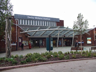
Shortly after I arrived at Derby station, the skies suddenly went very dark, followed by very heavy rain. I had just got there in time to avoid a thorough soaking! Here I caught a train home, changing trains at Nottingham.
At least I got some good mileage done. Also, I saw a bit of Derbyshire I was not really familiar with at all. All in all not a bad walk, though not as pretty as the Peak District!


No comments:
Post a Comment