Carrick Castle Holiday, 25th April to 2nd May 2015
This is not a walking event - it has been included in my blog for convenience.I stayed for a week in beautiful Carrick Castle on Loch Goil, west of Glasgow. These photos record some of the highlights of my visit.
I arrived on a beautiful afternoon. The views of Loch Goil were simply stunning. Here is a view looking north from Carrick Castle, with the castle keep in the foreground.

Turning to the south, the view was equally good, with Loch Long in the far distance.

The keep of Carrick Castle was looking very sad and neglected - a great shame!

In the evening, I went on a walk southwards along the loch shore. Here is the view northwards from just south of Ardnahein. It was beginning to get dark, so I quickly retraced my steps from here.

On the Sunday, I toured the Gare Loch area before passing through Helensburgh and Dumbarton to Glasgow. No photos, I am afraid!
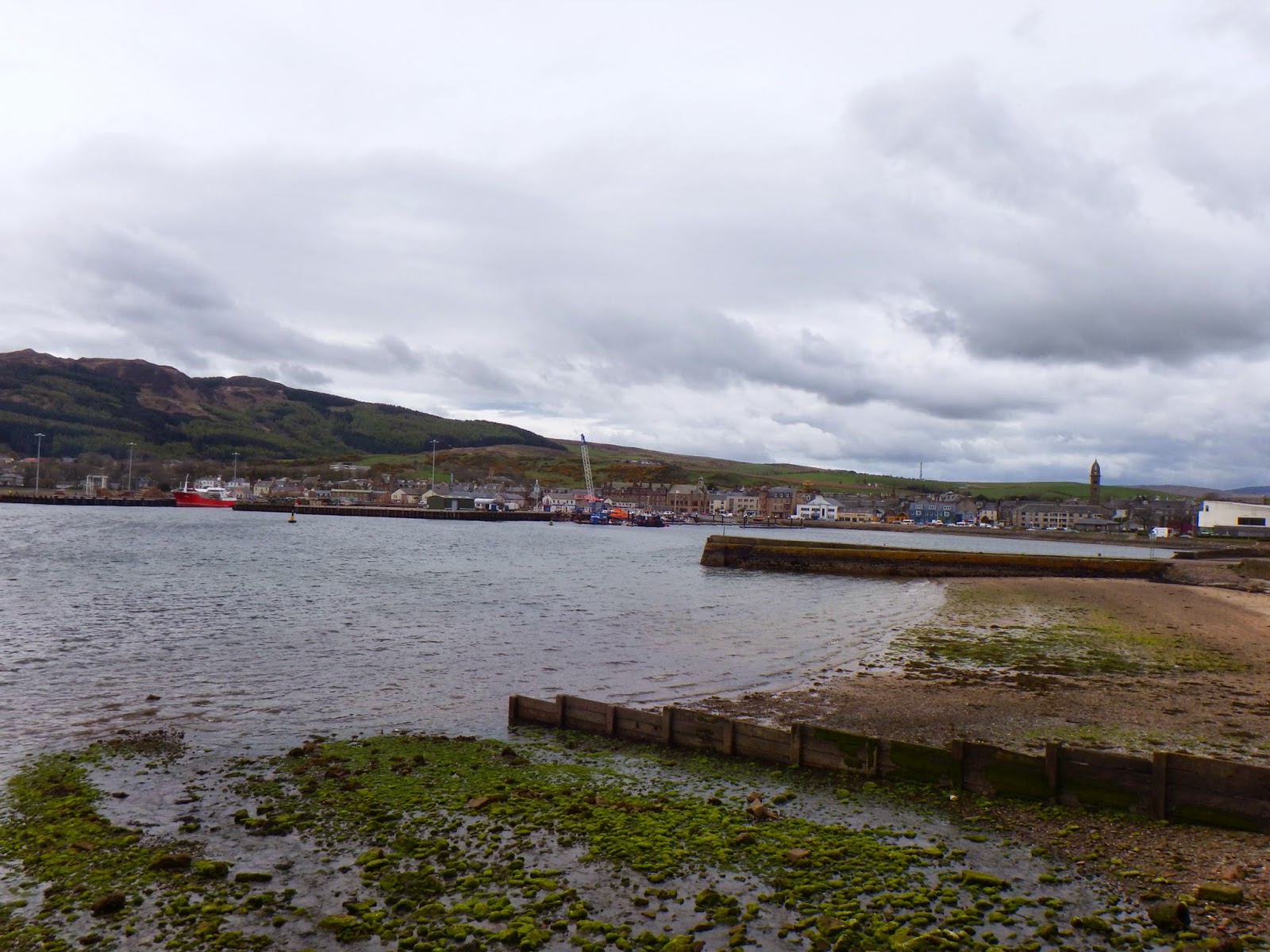
Monday started a glorious day, with beautiful sunshine and blue skies. I had decided to drive to the Mull of Kintyre, around 100 miles away by road. The first major settlement en route was Inveraray on Loch Fyne.

From Inveraray, I travelled south along Loch Fyne through Lochgilphead and Tarbert. Just south of Tarbert, I turned off the main road onto the B8001 to Skipness on the Sound of Bute. A ferry runs from Claonaig to the Isle of Arran. Here is a view of Arran from near Skipness.

I then continued south along the narrow single track coast road along the eastern side of the peninsula, through Crossaig and Grogport. There were good view down the coast and of Arran for much of the way. Here is a view looking south along the coast from near Crossaig.

Carradale has a little harbour.

Approaching Campbeltown, Arran was still clearly visible across Kilbrannan Sound.

The road swung west past Davaar Island and into Campbeltown, a small but very interesting town.
From the waterfront, Davaar Island dominates the mouth of Campbeltown Loch.

Campbeltown had some very interesting buildings, including the Public Library.........

..........and the Art Deco cinema.

Leaving Campbeltown, I headed round the lock on another very narrow road towards Davaar. This was my last view of Arran and Davaar Island.

To the south, the road headed around the coast. Ailsa Craig became clearly visible on the horizon (mid left of the photo)

Here it is again, from the cliff tops near Feochaig. The land in the distance is the Scottish mainland, all the way south to The Rinns Of Galloway, near Stranraer.

............and even closer! The weather was beginning to get very dull by now, with thick black clouds billowing in from the west.

I caught a brief glimpse across country towards the Mull of Kintyre.

Southend was very stormy. A heavy rain shower came down, complete with near-horizontal rain. I stopped here and ate my lunch. Sanda Island was visible in the far distance. There was a vague view of the Irish coast too, but it was too poor to even try and take a photo.

I decided to take the road to the Mull of Kintyre lighthouse at the far south western tip of Kintyre. This was as just about as narrow as a road could get. Fortunately, I only met one other vehicle in all the distance there and back. Amazingly, the weather improved dramatically in a very short time, just as I reached the summit of the road. The final descent to the lighthouse is closed to public road traffic, though you can walk down. I chose just to admire the views from the top of the hill adjacent to the turning point. The weather front had passed through, leaving the seascape bathed in sunshine. The Irish coast (left) and Rathlin Island (far right) were visible in the distance for a while, before distant rain obscured them.

I now began the return journey, following the western coast as far as possible. First, I had to retrace my steps east along the lighthouse road. This gave a fine view of Southend, Sanda Island and Sheep Island (the tiny one).

I called briefly at Machrihanish before rejoining the main road north along the coast. Another bout of bad weather bscured the views for a while, but the sun came out again south of Tarbert. There was a good view of West Loch Tarbert from the road.

Near Tarbert, I turned off the main road again, following the western shore of West Loch Tarbert efore turning north along Loch Caolisport. In this view, the Point of Knap is visible on the right, with the Isle of Jura in the far distance on the left.

The end of the loch was beautiful in the sunshine.

I then turned left along another very minor road to St Columba's Cave.

The cave itself is a short distance from the road.

Inside, there is a small stone shrine.

A close look revealed some coins and wooden crosses.

Here is the view from inside the cave towards the daylight.

I then headed back to the B8024 towards Lochgilphead. This offered a good view of Loch Fyne in the distance.

No comments:
Post a Comment